Harrison Township, Pulaski County, Indiana
Harrison Township | |
|---|---|
| Nickname(s): "Millcreekers" | |
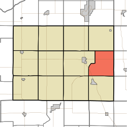 Location in Pulaski County | |
| Coordinates: 41°02′15″N 86°30′57″W / 41.03750°N 86.51583°WCoordinates: 41°02′15″N 86°30′57″W / 41.03750°N 86.51583°W | |
| Country | |
| State | |
| County | Pulaski |
| Government | |
| • Type | Indiana township |
| Area | |
| • Total | 31.6 sq mi (82 km2) |
| • Land | 31.51 sq mi (81.6 km2) |
| • Water | 0.09 sq mi (0.2 km2) 0.28% |
| Elevation | 712 ft (217 m) |
| Population (2010) | |
| • Total | 628 |
| • Density | 19.9/sq mi (7.7/km2) |
| ZIP codes | 46939, 46960, 46985, 46996 |
| GNIS feature ID | 453395 |

Harrison Township is one of twelve townships in Pulaski County, Indiana, United States. As of the 2010 census, its population was 628 and it contained 288 housing units.[1]
History[]
Harrison Township was organized in 1841, and named for William Henry Harrison (1773–1841), the ninth President of the United States (1841).[2]
Geography[]
According to the 2010 census, the township has a total area of 31.6 square miles (82 km2), of which 31.51 square miles (81.6 km2) (or 99.72%) is land and 0.09 square miles (0.23 km2) (or 0.28%) is water.[1]
Adjacent townships[]
- Tippecanoe Township (north)
- Aubbeenaubbee Township, Fulton County (northeast)
- Union Township, Fulton County (east)
- Wayne Township, Fulton County (southeast)
- Van Buren Township (south)
- Indian Creek Township (southwest)
- Monroe Township (west)
Major highways[]
Lakes[]
- Bruce Lake
Education[]
- Eastern Pulaski Community School Corporation
Harrison Township residents may obtain a free library card from the Pulaski County Public Library in Winamac.[3]
Political districts[]
- Indiana's 2nd congressional district
- State House District 20
- State Senate District 18
References[]
- United States Census Bureau 2008 TIGER/Line Shapefiles
- United States Board on Geographic Names (GNIS)
- IndianaMap
- ^ a b "Population, Housing Units, Area, and Density: 2010 - County -- County Subdivision and Place -- 2010 Census Summary File 1". United States Census. Archived from the original on 2020-02-12. Retrieved 2013-05-10.
- ^ Counties of White and Pulaski, Indiana: Historical and Biographical. F.A. Battey & Company. 1883. p. 548.
- ^ "The Library District". Pulaski County Public Library. Retrieved 14 March 2018.
External links[]
Places adjacent to Harrison Township, Pulaski County, Indiana | |
|---|---|
Municipalities and communities of Pulaski County, Indiana, United States | ||
|---|---|---|
| Towns | ||
| Townships | ||
| CDP | ||
| Other unincorporated communities | ||
| ||
Categories:
- Townships in Pulaski County, Indiana
- Townships in Indiana