Hawthorne Municipal Airport (California)
Hawthorne Municipal Airport Jack Northrop Field | |||||||||||
|---|---|---|---|---|---|---|---|---|---|---|---|
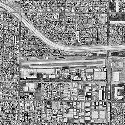 1994 USGS photo | |||||||||||
| Summary | |||||||||||
| Airport type | Public | ||||||||||
| Operator | City of Hawthorne | ||||||||||
| Location | Hawthorne, California | ||||||||||
| Elevation AMSL | 66 ft / 20 m | ||||||||||
| Coordinates | 33°55′22″N 118°20′07″W / 33.92278°N 118.33528°WCoordinates: 33°55′22″N 118°20′07″W / 33.92278°N 118.33528°W | ||||||||||
| Website | City of Hawthorne | ||||||||||
| Map | |||||||||||
 KHHR Location | |||||||||||
| Runways | |||||||||||
| |||||||||||

Hawthorne Municipal Airport (IATA: HHR, ICAO: KHHR) (Jack Northrop Field) is an airport a mile (2 km) east of Hawthorne, in Los Angeles County, California, United States.
Facilities[]
The airport covers 80 acres (32 ha); its one runway, 7/25, is 4,884 ft × 100 ft (1,489 m × 30 m) concrete. It is effectively crammed into a very small space and is surrounded by residential areas on all sides. The airport is also in very close proximity to the considerably larger Los Angeles International Airport, so special consideration must be given attention to avoid encroaching on the LAX airspace.
FBOs:[1]
- Hawthorne Hangar Operations[2]
- JetCenterLA
Airport businesses:
History[]
The name "Jack Northrop Field" comes from the Northrop Aircraft Corporation, founded by Jack Northrop, which for years designed, built and flew many classic airplanes including YB-35 flying wing, the P-61 Black Widow and F-89 Scorpion night fighters, the F-5 Freedom Fighter, and the T-38 Talon jet trainer.[5]
During World War II, the airfield was used by the United States Army Air Forces Air Technical Service Command as an aircraft modification center and Air Transport Command to ferry new aircraft to operational units.
SpaceX and its spinoff The Boring Company are headquartered at the southeast end of the airport. The Boring Test Tunnel cuts runs just under the fence line at the north-east corner before running under West 120th Street. Tesla Design Studio is located at the airport as well.[6]
Airlines and destinations[]
| Airlines | Destinations | Refs |
|---|---|---|
| Advanced Air | Phoenix–Sky Harbor Seasonal: Mammoth Lakes[7] | [8] |
| Taos Air | Seasonal: Taos[9] | [10] |
Taos Air operates seasonal skiing-oriented flights between Hawthorne Municipal and Taos Regional Airport in New Mexico.[10]
See also[]

FAA diagram

References[]
![]() This article incorporates public domain material from the Air Force Historical Research Agency website http://www.afhra.af.mil/.
This article incorporates public domain material from the Air Force Historical Research Agency website http://www.afhra.af.mil/.
- ^ "AirNav: KHHR - Jack Northrop Field/Hawthorne Municipal Airport". www.airnav.com. Retrieved 2021-01-08.
- ^ Hawthorne Hangar Operations
- ^ Star Helicopters
- ^ Capital Jet Management
- ^ "Hawthorne Municipal Airport's roots lie in the early days of the aerospace industry | South Bay History". blogs.dailybreeze.com. Retrieved 2021-01-08.
- ^ "Hawthorne Airport FAQ" (PDF).
- ^ https://info.advancedairlines.com/mammoth-2021-postponed
- ^ "Route Map and Schedule".
- ^ https://www.sandiegouniontribune.com/business/story/2021-05-24/craving-a-summer-getaway-to-a-ski-town-taos-air-will-fly-you-there-from-carlsbad
- ^ Jump up to: a b "Taos Air launching round-trip flights to LA and Carlsbad, Calif". Albuquerque Journal. Albuquerque, New Mexico. 20 November 2019. Retrieved 21 November 2019.
- Airport Master Record (FAA Form 5010), also available as a printable form (PDF)
- Hawthorne Municipal Airport (City of Hawthorne website)
- AirNav KHHR
- Second FBO Opens at SoCal's Hawthorne Airport
External links[]
- FAA Airport Diagram (PDF), effective August 12, 2021
- Airfields of the United States Army Air Forces in California
- Airfields of the United States Army Air Forces Technical Service Command
- Airports in Los Angeles County, California
- Hawthorne, California