Hei- en Boeicop
Coordinates: 51°57′N 5°5′E / 51.950°N 5.083°E

Hei- en Boeicop | |
|---|---|
 | |
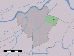 The village centre (dark green) and the statistical district (light green) of Hei- en Boeicop in the former municipality of Zederik. | |
| Country | Netherlands |
| Province | Utrecht |
| Municipality | Vijfheerenlanden |
| Population | ca. 980 |
| Postcode | 4126 |
| Area code | 0345 |
Hei- en Boeicop is a small village in the Dutch province of Utrecht. Part of the municipality of Vijfheerenlanden, it lies about 9 km south of IJsselstein. The statistical area "Hei- en Boeicop", which includes the surrounding countryside, has a population of around 940.[1]
The village consists of a long row of houses on two sides of a small canal that separates the Polder Boeicop to the north from the Polder Heicop to the south.
Hei- en Boeicop was an independent municipality in the province of South Holland between 1817 and 1986, when it became part of Zederik.[2] When Zederik merged into the new municipality Vijfheerenlanden in 2019, it became a part of the province of Utrecht.[3]
References[]
- ^ Statistics Netherlands (CBS), Statline: Kerncijfers wijken en buurten 2003-2005. As of 1 January 2005.
- ^ Ad van der Meer and Onno Boonstra, Repertorium van Nederlandse gemeenten, KNAW, 2011.
- ^ "Fusiegemeente Vijfheerenlanden in provincie Utrecht". AD.nl. Retrieved 12 January 2019.
External links[]
- Map of the former municipality in 1866
This Utrecht location article is a stub. You can help Wikipedia by . |
- Populated places in Utrecht (province)
- Former municipalities of South Holland
- Vijfheerenlanden
- Utrecht (province) geography stubs