Heroldstatt
show This article may be expanded with text translated from the corresponding article in German. (February 2009) Click [show] for important translation instructions. |
Heroldstatt | |
|---|---|
 Coat of arms | |
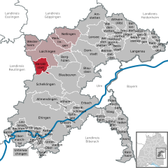
show Location of Heroldstatt within Alb-Donau-Kreis district | |
 Heroldstatt | |
| Coordinates: 48°26′47″N 9°40′18″E / 48.44639°N 9.67167°ECoordinates: 48°26′47″N 9°40′18″E / 48.44639°N 9.67167°E | |
| Country | Germany |
| State | Baden-Württemberg |
| Admin. region | Tübingen |
| District | Alb-Donau-Kreis |
| Subdivisions | 2 |
| Government | |
| • Mayor (2018–26) | Michael Weber[1] |
| Area | |
| • Total | 21.81 km2 (8.42 sq mi) |
| Elevation | 770 m (2,530 ft) |
| Population (2020-12-31)[2] | |
| • Total | 2,831 |
| • Density | 130/km2 (340/sq mi) |
| Time zone | UTC+01:00 (CET) |
| • Summer (DST) | UTC+02:00 (CEST) |
| Postal codes | 72535 |
| Dialling codes | 07389 |
| Vehicle registration | UL |
| Website | www.heroldstatt.de |


Heroldstatt is a village in the district of Alb-Donau in Baden-Württemberg in Germany.
Geography[]
Heroldstatt is located on the Swabian Jura about 25 kilometers west of Ulm.
Neighboring communities[]
The municipality borders in the north and east to the town of Laichingen, in the southeast to the town of Blaubeuren , in the south to the town of Schelklingen (all Alb-Donau-district) and in the west to Gutsbezirk Münsingen (district Reutlingen).
Municipality arrangement[]
The municipality consists of the two districts Ennabeuren and Sontheim and the allotment Breithülen.
History[]
Ennabeuren[]
A documentary mention was made in 1092 to a nobleman Egilolf Oninburrin. In 1806, the village had around 300 Protestant and 200 Catholic residents. Ennabeuren lost in 1895 and 1938 a total of 940 hectares - about half of the municipal area - to the military training area Münsingen.
Sontheim[]
During the Reformation the village received in 1537 its own parish. By 1800 it had about 420 inhabitants.


Heroldstatt[]
The two previously independent municipalities joined as part of the municipal reform on October 1, 1973 together. About halfway between the village centers a new community center with the mountain hall (multi-purpose hall, 1984, extended in 2000) and the town hall (1987) was erected.
Breithülen[]
The 77.5 hectare and 64 inhabitants allotment Breithülen was incorporated to Heroldstatt on January 1, 2011.
Lookout[]
- The 30 m high Heroldstatt tower is about 2 kilometers northwest of the district Ennabeuren on the former military training area Münsingen and was built in 1981. The tower of the Schwäbischer Albverein is freely accessible (key deposit).[3]
Wind power test field[]
Northeast of the town there is a testing ground for Wind turbines. To this belongs a 1989 erected Enercon E-17 with 28 m hub height, 17 m rotor diameter and 80 kW power and a 25 m high Darrieus rotor with 15 m diameter which has an output of 55 kW.[4]

Natural monuments[]
- Sontheimer Höhle, the oldest show cave in Germany
- Hintere Kohlhaldenhöhle
Literatur[]
- Der Alb-Donau-Kreis. Amtliche Kreisbeschreibung, Band 2, Landesarchivdirektion Baden-Württemberg (Hrsg.), Sigmaringen 1992, ISBN 3-7995-1351-5, S. 307–328
- Karl Schnizer: Reformationsgeschichte von Enabeuren O. A. Münsingen. In: Blätter für württembergische Kirchengeschichte. N. F., 11. Jg. 1907, S. 62–68 (Digitalisat)
References[]
- ^ Aktuelle Wahlergebnisse, Staatsanzeiger, accessed 11 September 2021.
- ^ "Bevölkerung nach Nationalität und Geschlecht am 31. Dezember 2020". Statistisches Landesamt Baden-Württemberg (in German). June 2021.
- ^ Schwäbischer Albverein - Heroldstatt-Turm
- ^ EnBW bricht historisches Windrad bei Heroldstatt ab. In: Schwäbische Zeitung, 17. Dezember 2012. Abgerufen am 17. Dezember 2012.
| show Towns and municipalities in Alb-Donau-Kreis |
|---|
| Authority control |
|---|
| Wikimedia Commons has media related to Heroldstatt. |
This Alb-Donau-Kreis location article is a stub. You can help Wikipedia by . |
- Municipalities in Baden-Württemberg
- Alb-Donau-Kreis
- Württemberg
- Tübingen region geography stubs