Unterstadion
show This article may be expanded with text translated from the corresponding article in German. (February 2009) Click [show] for important translation instructions. |
Unterstadion | |
|---|---|
 Coat of arms | |
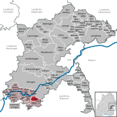
show Location of Unterstadion within Alb-Donau-Kreis district | |
 Unterstadion | |
| Coordinates: 48°12′12″N 9°41′22″E / 48.20333°N 9.68944°ECoordinates: 48°12′12″N 9°41′22″E / 48.20333°N 9.68944°E | |
| Country | Germany |
| State | Baden-Württemberg |
| Admin. region | Tübingen |
| District | Alb-Donau-Kreis |
| Government | |
| • Mayor (2019–27) | Uwe Handgrätinger[1] |
| Area | |
| • Total | 8.84 km2 (3.41 sq mi) |
| Elevation | 508 m (1,667 ft) |
| Population (2020-12-31)[2] | |
| • Total | 778 |
| • Density | 88/km2 (230/sq mi) |
| Time zone | UTC+01:00 (CET) |
| • Summer (DST) | UTC+02:00 (CEST) |
| Postal codes | 89619 |
| Dialling codes | 07393 |
| Vehicle registration | UL |
| Website | www.unterstadion.de |


Stehenbach River in Unterstadion

Schwester-Ulrike-Nisch-Strasse, Unterstadion

Entrance to Friedhof, Unterstadion

Crucifix in Unterstadion Friedhof

Gemeinde (Community Center) Unterstadion
Unterstadion is a municipality in the district of Alb-Donau in Baden-Württemberg in Germany.
References[]
- ^ Aktuelle Wahlergebnisse, Staatsanzeiger, accessed 11 September 2021.
- ^ "Bevölkerung nach Nationalität und Geschlecht am 31. Dezember 2020". Statistisches Landesamt Baden-Württemberg (in German). June 2021.
| show Towns and municipalities in Alb-Donau-Kreis |
|---|
| Authority control |
|---|
This Alb-Donau-Kreis location article is a stub. You can help Wikipedia by . |
Categories:
- Municipalities in Baden-Württemberg
- Alb-Donau-Kreis
- Württemberg
- Tübingen region geography stubs