Herrngiersdorf
show This article may be expanded with text translated from the corresponding article in German. (March 2009) Click [show] for important translation instructions. |
Herrngiersdorf | |
|---|---|
 Coat of arms | |
show Location of Herrngiersdorf within Kelheim district | |
 Herrngiersdorf | |
| Coordinates: 48°48′N 12°4′E / 48.800°N 12.067°ECoordinates: 48°48′N 12°4′E / 48.800°N 12.067°E | |
| Country | Germany |
| State | Bavaria |
| Admin. region | Niederbayern |
| District | Kelheim |
| Municipal assoc. | Langquaid |
| Area | |
| • Total | 25.09 km2 (9.69 sq mi) |
| Elevation | 405 m (1,329 ft) |
| Population (2020-12-31)[1] | |
| • Total | 1,324 |
| • Density | 53/km2 (140/sq mi) |
| Time zone | UTC+01:00 (CET) |
| • Summer (DST) | UTC+02:00 (CEST) |
| Postal codes | 84097 |
| Dialling codes | 09452 |
| Vehicle registration | KEH |
| Website | www |


Herrngiersdorf is a municipality in the district of Kelheim in Bavaria in Germany. The village is dominated by the large, square Schloss Herrngiersdorf, a brewery.
Geography[]
Herrngiersdorf is located south of Langquaid and consists of Herrngiersdorf, Sandsbach, Semerskirchen, and Sittelsdorf.
Gallery[]

Lake at Semerskirchen
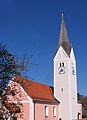
St. Martin's church


References[]
| Wikimedia Commons has media related to Herrngiersdorf. |
| Wikivoyage has a travel guide for Herrngiersdorf. |
| show Towns and municipalities in Kelheim (district) |
|---|
| Authority control |
|---|
This Kelheim district location article is a stub. You can help Wikipedia by . |
Categories:
- Municipalities in Bavaria
- Kelheim (district)
- Lower Bavaria geography stubs