Herwijnen
Herwijnen | |
|---|---|
Village | |
 Coat of arms | |
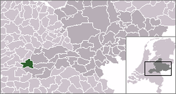 | |
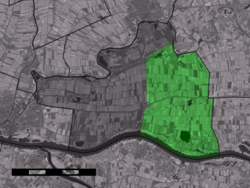 The village centre (dark green) and the statistical district (light green) of Herwijnen in the former municipality of Lingewaal. | |
| Coordinates: 51°49′31″N 5°7′49″E / 51.82528°N 5.13028°ECoordinates: 51°49′31″N 5°7′49″E / 51.82528°N 5.13028°E | |
| Country | Netherlands |
| Province | Gelderland |
| Municipality | West Betuwe |
| Population (2006) | |
| • Total | 2,500 |
| Time zone | UTC+1 (CET) |
| • Summer (DST) | UTC+2 (CEST) |

Herwijnen is a village in the Dutch province of Gelderland. It is a part of the municipality of West Betuwe, and lies about 11 km east of Gorinchem.
Herwijnen was a separate municipality until 1986, when it was merged with Vuren, Asperen, Heukelum and Spijk as municipality of Lingewaal.[1] Since 2019 Lingewaal merged with Geldermalsen and Neerijnen in the new municipality of West Betuwe.
In 2001, the village of Herwijnen had 1494 inhabitants. The built-up area of the village was 0.34 km², and contained 550 residences.[2] The statistical area "Herwijnen", which also can include the peripheral parts of the village, as well as the surrounding countryside, has a population of around 2470.[3]
Born[]
- Patrick Vroegh (1999), football player
References[]
- ^ Ad van der Meer and Onno Boonstra, Repertorium van Nederlandse gemeenten, KNAW, 2011.
- ^ Statistics Netherlands (CBS), Bevolkingskernen in Nederland 2001 Archived 2006-03-19 at the Wayback Machine. (Statistics are for the continuous built-up area).
- ^ Statistics Netherlands (CBS), Statline: Kerncijfers wijken en buurten 2003-2005. As of 1 January 2005.
External links[]
| hide Authority control | |
|---|---|
| General |
|
| National libraries | |
This Gelderland location article is a stub. You can help Wikipedia by . |
- Populated places in Gelderland
- Former municipalities of Gelderland
- West Betuwe
- Gelderland geography stubs