Heves District
Heves District
Hevesi járás | |
|---|---|
 Coat of arms | |
 Heves District within Hungary and Heves County. | |
| Country | |
| County | Heves |
| District seat | Heves (town) |
| Area | |
| • Total | 697.68 km2 (269.38 sq mi) |
| Area rank | 2nd in Heves |
| Population (2011 census) | |
| • Total | 35,036 |
| • Rank | 4th in Heves |
| • Density | 50/km2 (100/sq mi) |
Heves (Hungarian: Hevesi járás) is a district in south-eastern part of Heves County. Heves is also the name of the town where the district seat is found. The district is located in the Northern Hungary Statistical Region.
Geography[]
Heves District borders with Füzesabony District to the northeast, Kunhegyes District (Jász-Nagykun-Szolnok County) to the southeast, Jászapáti District (Jász-Nagykun-Szolnok County) to the southwest, Gyöngyös District to the northwest. The number of the inhabited places in Heves District is 17.
Municipalities[]
The district has 2 towns and 15 villages. (ordered by population, as of 1 January 2012)[1]
The bolded municipalities are cities.
Demographics[]
Religion in Heves District (2011 census)
In 2011, it had a population of 35,036 and the population density was 50/km².
| Year | County population[2] | Change |
|---|---|---|
| 2011 | 35,036 | n/a |
Ethnicity[]
Besides the Hungarian majority, the main minority is the Roma (approx. 5,500).
Total population (2011 census): 35,036
Ethnic groups (2011 census):[3] Identified themselves: 35,799 persons:
- Hungarians: 30,343 (84.76%)
- Gypsies: 5,182 (14.48%)
- Others and indefinable: 274 (0.77%)
Approx. 1,000 persons in Heves District did declare more than one ethnic group at the 2011 census.
Religion[]
Religious adherence in the county according to 2011 census:[4]
- Catholic – 19,112 (Roman Catholic – 19,045; Greek Catholic – 64);
- Reformed – 1,932;
- Evangelical – 66;
- other religions – 454;
- Non-religious – 5,095;
- Atheism – 158;
- Undeclared – 8,219.
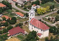
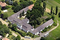
Gallery[]


See also[]
References[]
- ^ A KSH 2012. évi helységnévkönyve
- ^ népesség.com, "Hevesi járás népessége"
- ^ 4.1.6.1 A népesség nemzetiség szerint, 2011, (in Hungarian) [1]
- ^ 4.1.7.1 A népesség vallás, felekezet szerint, 2011, (in Hungarian) [2]
External links[]
| Towns (2) | ||
|---|---|---|
| Villages (15) | ||
Coordinates: 47°36′00″N 20°21′00″E / 47.6000°N 20.3500°E

This Heves county location article is a stub. You can help Wikipedia by . |
- Districts in Heves County
- Heves geography stubs