Hibberts Gore, Maine
Hibberts Gore, Maine | |
|---|---|
Gore | |
| Gore of Hibberts Gore | |
| Nickname(s): | |
 Location in Lincoln County and the state of Maine. | |
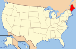 Maine's location in the United States. | |
| Coordinates: 44°19′33″N 69°25′39″W / 44.32583°N 69.42750°WCoordinates: 44°19′33″N 69°25′39″W / 44.32583°N 69.42750°W | |
| Country | |
| State | |
| U.S. Congressional District | ME-1 |
| County | Lincoln |
| Area | |
| • Total | 1.95 km2 (0.752 sq mi) |
| • Land | 1.93 km2 (0.745[2] sq mi) |
| • Water | 0.02 km2 (0.007[2] sq mi) |
| Elevation | 91 m (299[1] ft) |
| Population (2020) | |
| • Total | 1 |
| • Density | 0.5/km2 (1/sq mi) |
| Time zone | UTC-5 (Eastern (EST)) |
| • Summer (DST) | UTC-4 (Eastern Daylight (EDT)) |
| ZIP codes | |
| Area code(s) | 207 |
| GNIS feature ID | 582518[1] |
| FIPS code | 23-015-32715[4] |
| Waterways | Crummett Brook[5] |

Hibberts Gore (also called Hibberts) is a gore in Lincoln County, Maine, United States. The gore's population was one as of the 2020 United States Census.[6]
History[]
Ignored by the surveyors who mapped Maine, it remained unincorporated as the rest of the state was divided into cities, towns, and plantations.
Geography[]
According to the United States Census Bureau, Hibberts Gore has a total area of 0.752 sq mi (1.95 km2), of which 0.745 sq mi (1.93 km2) is land and 0.007 sq mi (0.02 km2), or 0.9%, is water.[2] The water is primarily wetlands, part of Sheepscot Pond, which is the headwaters of Sheepscot River.
Demographics[]
| Historical population | |||
|---|---|---|---|
| Census | Pop. | %± | |
| 1940 | 1 | — | |
| 1950 | 1 | 0.0% | |
| 1980 | 2 | — | |
| 1990 | 1 | −50.0% | |
| 2000 | 1 | 0.0% | |
| 2010 | 1 | 0.0% | |
| 2018 (est.) | 1 | 0.0% | |
| U.S. Decennial Census[7] | |||
As of the Census of 2020, there was 1 person, 1 household, and 0 families in Hibberts Gore.
See also[]
- Monowi, Nebraska – an incorporated village with a population of one.
References[]
- ^ a b c d e "Hibberts Gore". Geographic Names Information System. United States Geological Survey. 1 September 1995. Retrieved 22 June 2015.
- ^ a b c 2010 Census National County Subdivisions Gazetteer Files for Maine (Report). U.S. Department of Commerce. 2010. Retrieved 22 June 2015.
- ^ "US Postal Code Boundaries". Google. Google Maps. 3 February 2014. Retrieved 22 June 2015.
- ^ U.S. Census Bureau. Census 2000. "Census Demographic Profiles, Hibberts Gore" (PDF). CenStats Databases. Retrieved 22 June 2015.[dead link]
- ^ "Crummett Brook". Geographic Names Information System. United States Geological Survey. 30 September 1980. Retrieved 22 June 2015.
- ^ "Explore Census Data". data.census.gov. Retrieved 2021-12-03.
- ^ "Census of Population and Housing". Census.gov. Retrieved June 4, 2015.
External links[]
Municipalities and communities of Lincoln County, Maine, United States | ||
|---|---|---|
| Towns |  | |
| Plantation | ||
| Unorganized territories | ||
| CDPs | ||
| Other villages | ||
| ||
Categories:
- Unorganized territories in Maine
- Populated places in Lincoln County, Maine