High Fichtel Mountains
| High Fichtel (Hohes Fichtelgebirge) | |
|---|---|
 Location of the High Fichtel | |
| Highest point | |
| Peak | Schneeberg |
| Elevation | 1,051 m above NN |
| Geography | |
 The High Fichtel within northeastern Bavaria
| |
| State | Bavaria, extreme east of the Czech Republic |
| Range coordinates | 50°03′00″N 11°51′00″E / 50.05000°N 11.85000°ECoordinates: 50°03′00″N 11°51′00″E / 50.05000°N 11.85000°E |
| Parent range | Thuringian-Franconian Highlands |

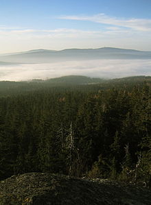

The High Fichtel Mountains[1] (German: Hohes Fichtelgebirge), or High Fichtel,[2] form a mountainous and heavily forested range consisting of several mountain chains in the shape of a horseshoe, the Fichtel Mountain Horseshoe (Fichtelgebirgs-Hufeisen), that rings the .
As a natural region the High Fichtel Mountains are major unit 394 within the major unit group of the Thuringian-Franconian Highlands (39), that run from the Thuringian Forest to the Fichtel Mountains.[3][4] Since September 2010 there is a new system for classifying the natural regions of northeast Bavaria, whereby the natural region of the High Fichtel only covers the central mountain region of the Scheeberg, Ochsenkopf and Kösseine, whilst the Waldstein ridge, the Steinwald and lower parts of the horseshoe represent special subordinate natural regions of the Fichtel Mountains.[5]
Geography[]
The High Fichtel Mountains begin in the northeast at the Kornberg, continue via the Waldstein, Schneeberg, Ochsenkopf and Königsheide in the southwest to the Kösseine, then over the Steinwald and Reichsforst to the in the southeast.
In the geomorphological division of the neighbouring Czech Republic, the Asch Hills (German: Ascher Hügelland; Czech: Ašská vrchovina), the Haslau Hills (Haslauer Hügelland or Hazlovská pahorkatina) and the Eger Hills (Egerer Hügelland or Chebská pahorkatina) are counted as part of the (High) Fichtel range.[6]
Geology[]
Geologically the mountain range consists mainly of granite. The history of its orogeny begins in the Pre-Cambrian about 750–800 million years ago – covering almost 20% of the earth's history, something which only applies to a few of the surviving ranges of the truncated Central Uplands of Germany today.
Mountains[]
The mountains of the High Fichtel include the following, sorted by their elevation in metres (m) above sea level (NN):
| Mountain | Height (m) | Remarks |
|---|---|---|
| Schneeberg | 1.051 | Highest mountain in the Fichtel range, Haberstein (923 m) on its southwestern slopes |
| Ochsenkopf | 1.024 | Winter sport, chair and drag lifts, (906 m) on the eastern slopes |
| Nußhardt | 972 | |
| Seehügel | 953 | (910 m) on southwestern slope |
| Platte (Steinwald) | 946 | |
| Kösseine | 939 | Subpeak of (922 m) |
| Platte (Schneeberg) | 885 | |
| 879 | Burgsteinfelsen at 869.2 m, (785 m) at northern foot | |
| Großer Waldstein | 877 | Winter sport, cross-country skiing trails |
| 866 | Rock formation at the summit and formation (850 m) 500 m to the southwest | |
| 863 | Winter sport, drag lifts | |
| 863 | ||
| Bergkopf (Waldstein) | 857 | 25 m high (817 m above NHN) graniterock formation of Hoher Stein at northeastern foot |
| 848 | ||
| Großer Kornberg | 827 | Winter sport, drag lift and cross-country skiing trails |
| Hohe Matze | 813 | (751 m) rock formation |
| Epprechtstein (Waldstein) | 798 | Winter sport, cross-country skiing trails |
| 768 | ||
| 767 | ||
| 732 | ||
| Armesberg | 731 | |
| 713 | ||
| 710 | ||
| 705 | ||
| 692 | Summit region is a nature reserve | |
| 686 | ||
| Teichelberg | 685 | |
| 675 | ||
| (German: Oberkunreuthberg) | 656 | |
| 643 | Winter sport, drag lift | |
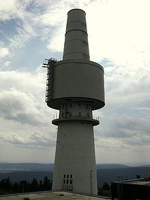
| (German: Grünberg) | 637 | transmission tower, viewing tower |
| 632 | observation tower | |
| 628 | ||
| 626 | ||
| 620 | near Konnersreuth | |
| 618 | ||
| 616 | ||
| 613 | near Konnersreuth |
Settlements[]
- Bischofsgrün
- Brand (Oberpfalz)
- Erbendorf
- Ebnath
- Fichtelberg
- Goldkronach
- Konnersreuth
- Mehlmeisel
- Nagel
- Neusorg
- Schönbrunn
- Sparneck
- Tröstau
- Warmensteinach
- Weißdorf
- Zell im Fichtelgebirge
Lakes and rivers[]
- See Fichtel Mountains article.
Transport[]
- Marktredwitz railway hub
- B 303 and B 15 federal highways
- A 93 and A 9 motorways
References[]
- ^ From Paleozoic to Quaternary: A Field Trip from the Franconian Alb to Bohemia edited by Ludwig Zöller. Retrieved 28 Jan 2014.
- ^ Travel Munich by MobileReference. Retrieved 28 Jan 2014.
- ^ E. Meynen and J. Schmithüsen: Handbuch der naturräumlichen Gliederung Deutschlands – Bundesanstalt für Landeskunde, Remagen/Bad Godesberg 1953-1962 (9 issues in 8 books, updated (1960) 1:1,000,000 map with major units)
- ^ Map services of the Federal Agency for Nature Conservation
- ^ Karl Heinrich Vollrath: Viola in Nordostbayern (Seite 132-133)
- ^ Smrčiny (Fichtelgebirge)
Sources[]
- Fritsch Wanderkarte 1:50.000 Fichtelgebirge-Steinwald, ISBN 978-3-86116-052-6
External links[]
- BfN - landscape fact file
- Natural regions of Germany
- Fichtel Mountains
- Mountain ranges of Bavaria