Mehlmeisel
Mehlmeisel | |
|---|---|
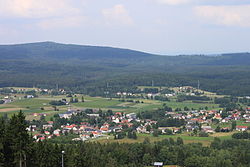 Panorama of the village | |
 Coat of arms | |
show Location of Mehlmeisel within Bayreuth district | |
 Mehlmeisel | |
| Coordinates: 49°58′34.32″N 11°51′17.92″E / 49.9762000°N 11.8549778°ECoordinates: 49°58′34.32″N 11°51′17.92″E / 49.9762000°N 11.8549778°E | |
| Country | Germany |
| State | Bavaria |
| Admin. region | Oberfranken |
| District | Bayreuth |
| Government | |
| • Mayor (2020–26) | Franz Tauber[1] (FW) |
| Area | |
| • Total | 13.23 km2 (5.11 sq mi) |
| Elevation | 621 m (2,037 ft) |
| Population (2020-12-31)[2] | |
| • Total | 1,319 |
| • Density | 100/km2 (260/sq mi) |
| Time zone | UTC+01:00 (CET) |
| • Summer (DST) | UTC+02:00 (CEST) |
| Postal codes | 95694 |
| Dialling codes | 09272 |
| Vehicle registration | BT |
| Website | www.mehlmeisel.de |


Mehlmeisel is a municipality in the district of Bayreuth in Bavaria in Germany.
References[]
- ^ Liste der ersten Bürgermeister/Oberbürgermeister in kreisangehörigen Gemeinden, Bayerisches Landesamt für Statistik, 15 July 2021.
- ^ "Tabellenblatt "Daten 2", Statistischer Bericht A1200C 202041 Einwohnerzahlen der Gemeinden, Kreise und Regierungsbezirke". Bayerisches Landesamt für Statistik (in German). June 2021.
| show Towns and municipalities in Bayreuth (district) |
|---|
| Authority control |
|---|
This Bayreuth district location article is a stub. You can help Wikipedia by . |
Categories:
- Municipalities in Bavaria
- Bayreuth (district)
- Upper Franconia geography stubs