Eckersdorf
Eckersdorf | |
|---|---|
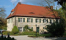
 Town hall | |
 Coat of arms | |
show Location of Eckersdorf within Bayreuth district | |
 Eckersdorf | |
| Coordinates: 49°55′57.97″N 11°30′4.43″E / 49.9327694°N 11.5012306°ECoordinates: 49°55′57.97″N 11°30′4.43″E / 49.9327694°N 11.5012306°E | |
| Country | Germany |
| State | Bavaria |
| Admin. region | Oberfranken |
| District | Bayreuth |
| Subdivisions | 22 districts[1] |
| Government | |
| • Mayor (2020–26) | Sybille Pichl[2] (FW) |
| Area | |
| • Total | 36.19 km2 (13.97 sq mi) |
| Elevation | 416 m (1,365 ft) |
| Population (2020-12-31)[3] | |
| • Total | 5,105 |
| • Density | 140/km2 (370/sq mi) |
| Time zone | UTC+01:00 (CET) |
| • Summer (DST) | UTC+02:00 (CEST) |
| Postal codes | 95488 |
| Dialling codes | 0921 |
| Vehicle registration | BT |
| Website | www.eckersdorf.de |


Eckersdorf is a municipality in the district of Bayreuth in Bavaria in Germany.
Geography[]
The municipality of Eckersdorf is located on the northern edge of an area called "Little Switzerland" (German: Fränkische Schweiz), close to the world-famous festival town of Bayreuth. The highest elevation in the region of Eckersdorf is the Sophienberg with an altitude of 593 m.
Districts[]
The present-day municipality of Eckersdorf was created in the course of municipal reform in 1978.
According to the information given by the local government, there are 22 official districts.[4]
| District | Population |
|---|---|
| Busbach | 227 |
| Donndorf | 2110 |
| Eckersdorf | 1952 |
| Eschen | 130 |
| Forst | 149 |
| Hardt | 31 |
| Heisenstein | 3 |
| Lahm | 29 |
| Lochau | 23 |
| Lohe | 24 |
| Melkendorf | 14 |
| Neustädtlein | 165 |
| Oberwaiz | 359 |
| Pleofen | 33 |
| Schanz | 19 |
| Simmelbuch | 70 |
| Stein | 1 |
| Tröbersdorf | 64 |
| Vorlahm | 19 |
| Waldhütte | 1 |
| Windhof | 9 |
| Wolfsgraben | 3 |
Neighboring communities[]
The neighboring communities of Eckersdorf are (starting north in clockwise order): Thurnau, Bayreuth, Mistelbach, and Mistelgau.
History[]
Eckersdorf was first mentioned in 1149 in the so-called Giechburgvertrag. The Counts of Andechs-Meranien (Grafen von Andechs-Meranien) owned the current area of Eckersdorf until they died off in 1248. The lords of Berg Plassenberg (Herren von Plassenberg) acquired first property in the Eckersdorf area in 1420. A hundred years later, the lords were in full possession of Eckersdorf. After the last representative of the family died in 1552, Eckersdorf came to the Lords of Lüchau, and then it fell to the Markgrafschaft Bayreuth in 1757. As part of the Prussian Principality of Bayreuth, Eckersdorf became a French possession through the Treaties of Tilsit, until 1810, when it became part of Bavaria. In the course of administrative reform in Bavaria in 1818, today's municipality Eckersdorf was created.[5]
Politics[]
At the latest elections for mayor in 2020, Sybille Pichl (Freie Wählergemeinschaft Eckersdorf-Donndorf und Umgebung) was re-elected. She has been in office since 2010.[2]
Sights[]

built Schloss Fantaisie for Margravine Elisabeth Fredericka Sophie of Brandenburg-Bayreuth from 1758 to 1765. Today, there is a garden museum in this rococo palace.

References[]
- ^ Daten/Zahlen/Fakten official webpage Eckersdorf.. Retrieved 2012-04-23.
- ^ Jump up to: a b Liste der ersten Bürgermeister/Oberbürgermeister in kreisangehörigen Gemeinden, Bayerisches Landesamt für Statistik, 15 July 2021.
- ^ "Tabellenblatt "Daten 2", Statistischer Bericht A1200C 202041 Einwohnerzahlen der Gemeinden, Kreise und Regierungsbezirke". Bayerisches Landesamt für Statistik (in German). June 2021.
- ^ Daten/Zahlen/Fakten official webpage Eckersdorf.. Retrieved 2011-04-29.
- ^ Geschichte (history, German language. Internet-site municipality Eckersdorf. 11. July 2010
| Wikimedia Commons has media related to Eckersdorf. |
| show Towns and municipalities in Bayreuth (district) |
|---|
| Authority control |
|---|
- Municipalities in Bavaria
- Bayreuth (district)