High Stones
| High Stones | |
|---|---|
 High Stones, Sheffield | |
| Highest point | |
| Elevation | 548 m (1,798 ft)[1] |
| Coordinates | 53°26′43″N 1°43′06″W / 53.44514°N 1.71842°WCoordinates: 53°26′43″N 1°43′06″W / 53.44514°N 1.71842°W |
| Geography | |
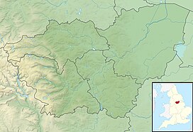 High Stones High Stones in South Yorkshire | |
| Location | South Yorkshire, |
| Parent range | Peak District |
| OS grid | SK188943 |

High Stones, at 548 metres (1,798 ft), is the highest point within the boundaries of both Sheffield and South Yorkshire, England.[1] Lying within the City of Sheffield, it is also the highest natural point above sea level in any English city.
High Stones lies on the Howden Moors towards in the northern Peak District National Park, between Langsett Reservoir to the north-east and Howden Reservoir to the south-west. The area is managed by the National Trust, as part of the Nether Hey area of their High Peak Estate.
Omission from List of Highest English Cities[]
In 2006, High Stones was not accounted for in a list produced by Ordnance Survey of the highest points above sea level of each city in England. The list was sent to British Member of Parliament Lynn Jones and was published in 2008 on a blog by John Mostyn.[2] The list referred to the highest point in Sheffield as 298 metres (978 ft), failing to recognise High Stones at 550 metres (1,804 ft). If the list had accounted for High Stones, Sheffield would have been recognised as the highest English city. The list of cities has since been widely quoted, for example by the Daily Telegraph.[3]
Representation on Mapping[]
High Stones is about 1 mile (1.6 km) south of Margery Hill which, at 546m, is the highest marked point within Sheffield. High Stones is only shown on 1:25,000 scale maps and larger.
The cairn at High Stones is at the marked 548 metres (1,798 ft) point; being something over two feet tall means that the top of the cairn is just over 1800 ft above sea level. The most recent 1:25,000 Ordnance Survey Map[4] shows a small 550m contour just west of the High Stones marked point, meaning that small patch of moorland is the highest point in Sheffield at just slightly over 550 metres (1,804 ft).
References[]
- ^ a b Bathurst, David (2012). Walking the county high points of England. Chichester: Summersdale. pp. 192–201. ISBN 978-1-84-953239-6.
- ^ johnmostyn (14 August 2008). "How high is Birmingham?". John Mostyn's Blog. Retrieved 12 September 2021.
- ^ Smith, Oliver (9 October 2017). "The UK's highest mountain? It's not what you think". The Telegraph. ISSN 0307-1235. Retrieved 12 September 2021.
- ^ "Ordnance Survey Map of High Stones". Archived from the original on 26 October 2012. Retrieved 6 February 2011.
Peaks of the Peak District of England | ||
|---|---|---|
| Marilyns |  | |
| Other peaks |
| |
List of peaks of the Peak District | ||
- Mountains and hills of the Peak District
- National Trust properties in South Yorkshire
- Hills and edges of South Yorkshire
- Geography of Sheffield
- Highest points of English counties