Highland County Airport
Highland County Airport | |||||||||||
|---|---|---|---|---|---|---|---|---|---|---|---|
| Summary | |||||||||||
| Airport type | Public | ||||||||||
| Owner | Highland County Commissioners | ||||||||||
| Serves | Hillsboro, Ohio | ||||||||||
| Elevation AMSL | 977 ft / 298 m | ||||||||||
| Coordinates | 39°11′19″N 083°32′19″W / 39.18861°N 83.53861°W | ||||||||||
| Map | |||||||||||
 HOC Location of airport in Ohio/United States | |||||||||||
| Runways | |||||||||||
| |||||||||||
| Statistics (2009) | |||||||||||
| |||||||||||


Highland County Airport (ICAO: KHOC, FAA LID: HOC) is a public-owned, public-use airport located at 9500 North Shore Drive three nautical mile (4.8 km) southeast of the central business district of the city of Hillsboro, in Highland County, Ohio, United States.[1]
Although many U.S. airports use the same three-letter location identifier for the FAA and IATA, this airport is assigned HOC by the FAA but has no designation from the IATA[2] (which assigned HOC to in Komako, Papua New Guinea[3]).
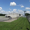
Gallery[]
Main office terminal

Airplane hangars
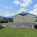
Hangar 6 Inc.

Hangar 6 Inc.

Security building


Facilities and aircraft[]
Highland County Airport covers an area of 15 acres (6.1 ha) at an elevation of 977 feet (298 m) above mean sea level. It has one asphalt paved runway: 05/23 is 3,520 by 75 feet (1,073 x 23 m).[1]
For the 12-month period ending May 22, 2009, the airport had 13,870 aircraft operations, an average of about 267 per week: 97% general aviation, 2% military, and 1% air taxi. At that time there were 21 aircraft based at this airport: 90% single-engine, 5% multi-engine, and 5% helicopter.[1]
References[]
- ^ a b c d FAA Airport Form 5010 for HOC PDF, effective 2009-05-22.
- ^ "Highland County Airport (ICAO: KHOC, FAA: HOC)". Great Circle Mapper. Retrieved 29 May 2010.
- ^ "Komako Airport HOC (IATA: HOC)". Great Circle Mapper. Retrieved 29 May 2010.
External links[]
- FAA Terminal Procedures for HOC, effective February 24, 2022
- Resources for this airport:
- FAA airport information for HOC
- AirNav airport information for HOC
- FlightAware airport information and live flight tracker
- SkyVector aeronautical chart for HOC
- Airports in Ohio
- Buildings and structures in Highland County, Ohio
- Transportation in Highland County, Ohio