Holedeč
Holedeč | |
|---|---|
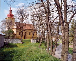 Church of Saint Bartholomew in Holedeček | |
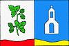 Flag  Coat of arms | |
 Holedeč Location in the Czech Republic | |
| Coordinates: 50°16′39″N 13°33′47″E / 50.27750°N 13.56306°ECoordinates: 50°16′39″N 13°33′47″E / 50.27750°N 13.56306°E | |
| Country | |
| Region | Ústí nad Labem |
| District | Louny |
| First mentioned | 1318 |
| Area | |
| • Total | 18.56 km2 (7.17 sq mi) |
| Elevation | 219 m (719 ft) |
| Population (2021-01-01)[1] | |
| • Total | 606 |
| • Density | 33/km2 (85/sq mi) |
| Time zone | UTC+1 (CET) |
| • Summer (DST) | UTC+2 (CEST) |
| Postal code | 438 01 |
| Website | www |

Holedeč is a municipality and village in Louny District in the Ústí nad Labem Region of the Czech Republic. It has about 600 inhabitants.
Holedeč lies approximately 20 kilometres (12 mi) south-west of Louny, 56 km (35 mi) south-west of Ústí nad Labem, and 64 km (40 mi) west of Prague.
Administrative parts[]
Villages of Holedeček, Stránky and Veletice are administrative parts of Holedeč.
References[]
| Wikimedia Commons has media related to Holedeč. |
| Authority control: National libraries |
|---|
This Ústí nad Labem Region location article is a stub. You can help Wikipedia by . |
Categories:
- Villages in Louny District
- Ústí nad Labem Region geography stubs