Hollandsche Rading
Hollandsche Rading | |
|---|---|
Town | |
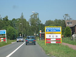 Entrance sign for Hollandsche Rading | |
 | |
 The town centre (dark green) and the statistical district (light green) of Hollandsche Rading in the municipality of De Bilt. | |
| Coordinates: 52°10′30″N 5°10′45″E / 52.17500°N 5.17917°ECoordinates: 52°10′30″N 5°10′45″E / 52.17500°N 5.17917°E | |
| Country | Netherlands |
| Province | Utrecht |
| Municipality | De Bilt |
| Population (1 January 2003) | |
| • Total | 1,424 |
| Time zone | UTC+1 (CET) |
| • Summer (DST) | UTC+2 (CEST) |
| Postal code | 3739 |
| Dialing code | 035 |

Hollandsche Rading is a town in the Dutch province of Utrecht. It is a part of the municipality of De Bilt, and lies about 5 km south of Hilversum. Hollandsche Rading has a railway station on the route between Utrecht and Hilversum.
In 2001, the town of Hollandsche Rading had 785 inhabitants. The built-up area of the town was 0.24 km², and contained 307 residences.[1] Including both the village itself and the surrounding area, the neighbourhood "Hollandsche Rading" has about 1690 inhabitants.[2]
The name means "Border of Holland": the village is located on the border between the provinces Utrecht and North Holland.
References[]
This Utrecht location article is a stub. You can help Wikipedia by . |
Categories:
- Populated places in Utrecht (province)
- De Bilt
- Utrecht (province) geography stubs