Hrhov
Hrhov | |
|---|---|
Village | |
 | |
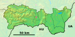 Hrhov Location of Hrhov in Slovakia | |
| Coordinates: 48°36′19″N 20°45′00″E / 48.60528°N 20.75000°ECoordinates: 48°36′19″N 20°45′00″E / 48.60528°N 20.75000°E | |
| Country | Slovakia |
| Region | Košice |
| District | Rožňava |
| Government | |
| • Mayor | Ladislav Tankó |
| Area | |
| • Total | 36.08 km2 (13.93 sq mi) |
| Elevation | 216 m (709 ft) |
| Population (2020) | |
| • Total | 1 044 |
| Postal code | 049 44 |
| Area code(s) | +421-58 |
| Car plate | RV |
| Website | https://www.hrhov.sk |


Hrhov (Hungarian: Tornagörgő) is a village and large municipality in the Rožňava District in the Košice Region of middle-eastern Slovakia.
History[]
In historical records the village was first mentioned in 1263.
Geography[]
The village lies at an altitude of 219 metres (719 ft) and covers an area of 36.078 km2 (13.930 sq mi). It has a population of about 1200 people.
Culture[]
The village has a public library, a gymnasium and a football pitch.
Genealogical resources[]
The records for genealogical research are available at the state archive "Statny Archiv in Kosice, Slovakia"
- Roman Catholic church records (births/marriages/deaths): 1697-1899 (parish A)
Nature[]

Hrhov Waterfall
In the village there is , which is the largest in the Slovak Karst. It is located directly in the village between the residential houses.[1]
See also[]
References[]
- ^ (in Slovak)"Hrhovský vodopád medzi domami a vyvieračka Féj". slovensky-kras.eu. Retrieved September 4, 2021.
External links[]
- https://web.archive.org/web/20070513023228/http://www.statistics.sk/mosmis/eng/run.html
- Hrhov
- Surnames of living people in Hrhov
| Authority control |
|
|---|
This Rožňava District geography article is a stub. You can help Wikipedia by . |
Categories:
- Villages and municipalities in Rožňava District
- Rožňava District geography stubs