Hsinchu Airport
Hsinchu Air Base | |||||||
|---|---|---|---|---|---|---|---|
新竹空軍基地 Xīnzhú Kōngjūn Jīdì | |||||||
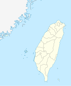
| Located in North, Hsinchu, Republic of China (Taiwan) | |||||||
 | |||||||
 Hsinchu Air Base | |||||||
| Coordinates | 24°49′05″N 120°56′21″E / 24.81806°N 120.93917°ECoordinates: 24°49′05″N 120°56′21″E / 24.81806°N 120.93917°E | ||||||
| Type | Military air base | ||||||
| Site information | |||||||
| Owner | |||||||
| Controlled by | |||||||
| Site history | |||||||
| In use | 19 May 1936–present | ||||||
| Airfield information | |||||||
| Identifiers | IATA: HSZ, ICAO: RCPO | ||||||
| Elevation | 26m (85ft) AMSL | ||||||
| |||||||
| Source: DAFIF[1][2] | |||||||


Radar station at Hsinchu AFB
Hsinchu Airport (Chinese: 新竹機場, IATA: HSZ, ICAO: RCPO) is an airport and military airbase in North District, Hsinchu City, Taiwan. It was constructed during the era of Japanese rule on 19 May 1936 and was named Shinchiku Airdrome (Japanese: 新竹飛行場). As of the late 1990s, the longest runway at Hsinchu was reportedly 12,000 feet (3658 m) long.
Stationed at Hsinchu AB:
- 499th Tactical Fighter Wing
- 41 Sqn (Mirage 2000-5)
- 42 Sqn (Mirage 2000–5)
- 48 Sqn (Mirage 2000–5).
See also[]
References[]
- ^ Airport information for RCPO at World Aero Data. Data current as of October 2006.Source: DAFIF.
- ^ Airport information for RCPO at Great Circle Mapper. Source: DAFIF (effective October 2006).
This article about an airport in Taiwan is a stub. You can help Wikipedia by . |
Categories:
- 1998 establishments in Taiwan
- Airports in Taiwan
- Republic of China Air Force
- Buildings and structures in Hsinchu
- Transportation in Hsinchu
- Taiwanese airport stubs