Hurstbourne Tarrant
This article needs additional citations for verification. (September 2014) |
| Hurstbourne Tarrant | |
|---|---|
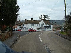 The George and Dragon | |
 Hurstbourne Tarrant Location within Hampshire | |
| Population | 864 (2011 Census including Pill Heath)[1] |
| OS grid reference | SU3837253292 |
| District | |
| Shire county | |
| Region | |
| Country | England |
| Sovereign state | United Kingdom |
| Post town | Andover |
| Postcode district | SP11 |
| Dialling code | 01264 |
| Police | Hampshire |
| Fire | Hampshire and Isle of Wight |
| Ambulance | South Central |
| UK Parliament | |

Hurstbourne Tarrant is a village and civil parish in Hampshire, England.[2][3] It lies to the north of the county in the Test Valley. The Tarrant part of the name originates from 1226, when the village was given to the Cistercian Tarrant nunnery. The civil parish includes the village of Ibthorpe.[3]
During the Second World War, Hurstbourne Tarrant was the decoy site for RAF Andover, the headquarters of RAF Maintenance Command. This was one of four airfields in Hampshire to be given a decoy site in 1940, to deceive enemy aircraft into attacking a spurious target. The decoy site at Hurstbourne Tarrant was a type 'K' decoy site with fake aircraft and buildings. From September 1940, fake machine gun posts were added to Hurstbourne Tarrant.[4]
The famous Victorian, Edwardian artist, the American, Anna Lea Merritt, lived in the village for many years.
William Cobbett declared Hurstbourne Tarrent and its location as worth going miles to see with beauty at every turn.[5] He referred to it in his book Rural Rides (1830) as Uphusband.
Hurstbourne House[]
Hurstbourne House is a grade II listed late 17th-century country house at the edge of the village. It was renovated in the late 18th and early 19th centuries. It is home to the Fane family. The original central range was built in two storeys, and has 19th century 3-storey cross wings at each end. The walls are stucco rendered and the roof tiled. The frontage has 3 bays, the central one recessed.[6]
See also[]
References[]
- ^ "Civil Parish population 2011". Neighbourhood Statistics. Office for National Statistics. Retrieved 21 December 2016.
- ^ Ordnance Survey: Landranger map sheet 185 Winchester & Basingstoke (Andover & Romsey) (Map). Ordnance Survey. 2013. ISBN 9780319228845.
- ^ a b "Ordnance Survey Election Maps". www.ordnancesurvey.co.uk. Ordnance Survey. Retrieved 3 April 2016.
- ^ Historic England. "Official UK National Monument Record webpage on Hurstbourne Tarrant decoy site (1465311)". Research records (formerly PastScape). Retrieved 4 April 2016.
- ^ The Kings England Hampshire and I.O.W., Arthur Mee., Publisher: Hodder & Stoughton (1950). ,ASIN:B000S3760G
- ^ "Hurstbourne House, Hurstbourne Tarrant". British Listed Buildings. Retrieved 7 June 2013.
External links[]
![]() Media related to Hurstbourne Tarrant at Wikimedia Commons
Media related to Hurstbourne Tarrant at Wikimedia Commons

This Hampshire location article is a stub. You can help Wikipedia by . |
- Villages in Hampshire
- Hampshire geography stubs