Hvolsvöllur
Hvolsvöllur | |
|---|---|
Town | |
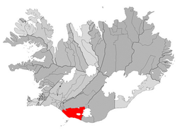 Location of the Municipality of Rangárþing eystra | |
 Hvolsvöllur Location in Iceland | |
| Coordinates: 63°45′N 20°14′W / 63.750°N 20.233°W | |
| Country | |
| Constituency | South Constituency |
| Region | Southern Region |
| Municipality | Rangárþing eystra |
| Population (2020) | |
| • Total | 1,036 |
| Time zone | UTC+0 (GMT) |
| Website | www |


Hvolsvöllur (Icelandic pronunciation: [ˈkʰvɔlsˌvœtlʏr̥, ˈxʷɔls-]) is a small town in the south of Iceland about 106 km to the east of Reykjavík.[1]
Overview[]
The name of the town literally translates to "Hillfield". Hvoll (hvols in the genitive case) is an archaic form of the modern Icelandic word hóll, meaning "hill", and völlur means "field". The name is derived from the name of the historic farm Stórólfshvoll ([ˈstouːroul(f)sˌkʰvɔtl̥, -ˌxʷɔtl̥], "Stórólfur's hill").[citation needed]
The hringvegur (road no.1) traverses the town which has 1036 inhabitants. In the surrounding areas there is an additional population of about 800 people, who are also part of the municipality.[citation needed]
Not far from Hvolsvöllur are an airfield and a port () that offer transportation to Vestmannaeyjar (Westman Islands).[citation needed]
The area is the scene of one of the most well-known[peacock term] sagas of Iceland, Njál's saga. The town of Hvolsvöllur has a Saga Centre dedicated to this and other Icelandic sagas.[citation needed]
In 2010, the volcanic eruptions at Eyjafjallajökull caused evacuations in the surrounding area, with people being relocated to Hvolsvöllur, where Red Cross mass care centres had been set up.[2]
Stórólfshvolskirkja [ˈstouːrou(l)fsˌkʰvɔlsˌcʰɪr̥ca, -ˌxʷɔls-] is a Protestant church in Hvolsvöllur. It was built in 1930 and can seat 120 people.[3] The interior was painted in 1955. Above the altar there is a painting by , a famous[peacock term] Icelandic painter, dating from 1914 which shows Jesus blessing the children.[citation needed]
Climate[]
Similar to the rest of the southern coast of Iceland, Hvolsvöllur has a subpolar oceanic climate (Köppen: Cfc) with cool summers and cold winters, although relatively mild for its high latitude. Precipitation is abundant year round, with October usually seeing the most precipitation.
| hideClimate data for Sámsstaðir, 6 km (3.7 mi) from Hvolsvöllur (1961–1990) | |||||||||||||
|---|---|---|---|---|---|---|---|---|---|---|---|---|---|
| Month | Jan | Feb | Mar | Apr | May | Jun | Jul | Aug | Sep | Oct | Nov | Dec | Year |
| Record high °C (°F) | 10.0 (50.0) |
12.0 (53.6) |
17.9 (64.2) |
15.4 (59.7) |
22.1 (71.8) |
21.5 (70.7) |
24.0 (75.2) |
22.1 (71.8) |
20.2 (68.4) |
15.9 (60.6) |
12.2 (54.0) |
10.8 (51.4) |
24.0 (75.2) |
| Average high °C (°F) | 2.2 (36.0) |
3.0 (37.4) |
3.6 (38.5) |
6.5 (43.7) |
10.3 (50.5) |
12.6 (54.7) |
14.3 (57.7) |
13.8 (56.8) |
10.7 (51.3) |
7.3 (45.1) |
3.5 (38.3) |
2.4 (36.3) |
7.5 (45.5) |
| Daily mean °C (°F) | −0.3 (31.5) |
0.5 (32.9) |
0.8 (33.4) |
3.4 (38.1) |
6.8 (44.2) |
9.4 (48.9) |
11.0 (51.8) |
10.5 (50.9) |
7.4 (45.3) |
4.5 (40.1) |
1.1 (34.0) |
−0.2 (31.6) |
4.6 (40.3) |
| Average low °C (°F) | −3.2 (26.2) |
−2.2 (28.0) |
−2.1 (28.2) |
0.2 (32.4) |
3.4 (38.1) |
6.3 (43.3) |
7.9 (46.2) |
7.4 (45.3) |
4.6 (40.3) |
1.9 (35.4) |
−1.6 (29.1) |
−3.0 (26.6) |
1.6 (34.9) |
| Record low °C (°F) | −17.9 (−0.2) |
−19.1 (−2.4) |
−17.0 (1.4) |
−19.2 (−2.6) |
−8.0 (17.6) |
−2.4 (27.7) |
1.0 (33.8) |
0.0 (32.0) |
−4.1 (24.6) |
−12.5 (9.5) |
−17.9 (−0.2) |
−18.2 (−0.8) |
−19.2 (−2.6) |
| Average precipitation mm (inches) | 110.8 (4.36) |
112.3 (4.42) |
113.3 (4.46) |
91.7 (3.61) |
68.6 (2.70) |
85.8 (3.38) |
85.7 (3.37) |
105.7 (4.16) |
102.4 (4.03) |
128.3 (5.05) |
113.0 (4.45) |
119.8 (4.72) |
1,237.2 (48.71) |
| Average precipitation days (≥ 0.1 mm) | 16.5 | 16.1 | 17.7 | 15.8 | 14.9 | 16.3 | 16.4 | 16.9 | 16.8 | 18.5 | 15.5 | 17.4 | 199.2 |
| Mean monthly sunshine hours | 28.2 | 50.8 | 99.0 | 138.2 | 175.4 | 151.1 | 159.0 | 145.1 | 120.6 | 80.1 | 43.5 | 16.9 | 1,207.9 |
| Source 1: Icelandic Met Office (monthly sunshine hours 1963-92) [4] | |||||||||||||
| Source 2: Icelandic Met Office (monthly precipitation days for Bjóla-12 km (7.5 mi) from Hvolsvöllur) [5] | |||||||||||||
Sports[]
See also[]
- List of cities in Iceland
References[]
- ^ https://www.south.is/en/inspiration/towns/hvolsvollur
- ^ "Hundreds evacuated after Icelandic volcano erupts, first since 1823". Thaindian News. 2010-03-21. Retrieved 2010-03-24.
- ^ http://kirkjukort.net/kirkjur/storolfshvolskirkja_069.html
- ^ "Sámsstaðir Monthly Climatological Data". Icelandic Meteorological Office. Retrieved 25 April 2021.
- ^ "1961-90 Climate Averages for Bjóla". Icelandic Meteorological Office. Retrieved 25 April 2021.

- Populated places in Southern Region (Iceland)