Hyūga Province
This article includes a list of general references, but it remains largely unverified because it lacks sufficient corresponding inline citations. (July 2013) |

Hyūga Province (日向国, Hyūga no kuni) was an old province of Japan on the east coast of Kyūshū, corresponding to the modern Miyazaki Prefecture.[1] It was sometimes called Nisshū (日州) or Kōshū (向州). Hyūga bordered on Bungo, Higo, Ōsumi, and Satsuma Province.
The ancient capital was near Saito.
History[]
In the Kojiki and the Nihon Shoki, Hyūga is called Kumaso Province (熊曽国, Kumaso no kuni) of Tsukushi-no-shima (Kyushu), along the provinces of Tsukushi, Toyo and Hi.
In the 3rd month of the 6th year of the Wadō era (713), the land of Hyūga was administratively separated from Ōsumi Province (大隅国). In that same year, Empress Genmei's Daijō-kan continued to organize other cadastral changes in the provincial map of the Nara period.[2]
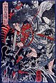
During the Sengoku period, the area was often divided into a northern fief around Agata castle (near modern Nobeoka), and a southern fief around Obi castle, near modern Nichinan. The southern fief was held by the Shimazu clan of nearby Satsuma for much of the period. The Itō clan held control of Hyuga until it was conquered by the Shimazu in 1578.
Historical districts[]
- Miyazaki Prefecture
- Koyu District (児湯郡)
- Miyazaki District (宮崎郡) - absorbed Kitanaka District on April 1, 1896; now dissolved
- (那珂郡)
- (北那珂郡) - merged into Miyazaki District on April 1, 1896
- Minaminaka District (南那珂郡) - dissolved
- (臼杵郡)
- Higashiusuki District (東臼杵郡)
- Nishiusuki District (西臼杵郡)
- Mixed
- (諸県郡)
- Higashimorokata District (東諸県郡) - became part of Miyazaki Prefecture on May 9, 1883
- Kitamorokata District (北諸県郡) - became part of Miyazaki Prefecture on May 9, 1883
- Minamimorokata District (南諸県郡) - became part of Kagoshima Prefecture on May 9, 1883; later merged with (東囎唹郡) (also from Kagoshima Prefecture) to become the 2nd incarnation of Soo District (囎唹郡) on March 29, 1896
- Nishimorokata District (西諸県郡) - became part of Miyazaki Prefecture on May 9, 1883
- (諸県郡)
See also[]
- Takanabe Domain
- IJN Hyūga, 1918-1945
- JDS Hyūga, 2009-present
Notes[]
- ^ Nussbaum, Louis-Frédéric. (2005). "Hyūga" in Japan Encyclopedia, p. 365, p. 365, at Google Books.
- ^ Titsingh, Isaac.. (1834). Annales des empereurs du japon, p. 64., p. 64, at Google Books
References[]
- Nussbaum, Louis-Frédéric and Käthe Roth. (2005). Japan encyclopedia. Cambridge: Harvard University Press. ISBN 978-0-674-01753-5; OCLC 58053128
- Titsingh, Isaac. (1834). Annales des empereurs du Japon (Nihon Ōdai Ichiran). Paris: Royal Asiatic Society, Oriental Translation Fund of Great Britain and Ireland. OCLC 5850691.
Other websites[]
![]() Media related to Hyuga Province at Wikimedia Commons
Media related to Hyuga Province at Wikimedia Commons

This Miyazaki Prefecture location article is a stub. You can help Wikipedia by . |
- Former provinces of Japan
- Miyazaki geography stubs