IJlst
This article needs additional citations for verification. (September 2014) |
IJlst
Drylts | |
|---|---|
City | |
 Former Town Hall | |
 Flag  Coat of arms | |
 Location in the former Wymbritseradiel municipality | |
 IJlst Location in the Netherlands | |
| Coordinates: Coordinates: 53°01′N 5°37′E / 53.017°N 5.617°E | |
| Country | Netherlands |
| Province | Friesland |
| Municipality | Súdwest-Fryslân |
| Population (2017) | |
| • Total | 3,140 |
| Time zone | UTC+1 (CET) |
| • Summer (DST) | UTC+2 (CEST) |
| Postal code | 8651 |
| Telephone area | 0515 |

IJlst (Dutch pronunciation: [ɛiɫst]; West Frisian: Drylts pronounced [drilts]) is a city in Friesland, Netherlands. It is located about 3 km southwest of Sneek. It lies within the municipality of Súdwest-Fryslân and had a population of approximately 3,140 in January 2017.[1]
History[]
It received city rights in 1268 and is one of the eleven cities in Friesland.
Between 1654 and 1664, Renier van Tzum was burgomaster of IJlst. Van Tzum was the opperhoofd or chief factor of the Dutch East India Company (Vereenigde Oost-Indische Compagnie or VOC) in Siam (1643–1644).[citation needed] He was also VOC opperhoofd in Japan (1644–1646).[2]
Before 2011, the city was part of the Wymbritseradiel municipality and before 1984 IJlst was an independent municipality.
Name[]
The name IJlst derives from the name of the river IJ or Ey. The river IJ is the central point of the little city. IJlst has a railway station located between the cities of Sneek and Stavoren.
Districts[]
The following districts are part of IJlst:
- Centrum (Oud IJlst)
- Roodhem
- Mientlan
- Noord
- Wiiddraai
- De Rat
- Cloosterkamp
- De Iendracht
Gallery[]
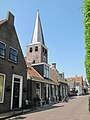
church
IJlst


References[]
- ^ Kerncijfers wijken en buurten 2017 - CBS Statline
- ^ Historigraphical Institute (Shiryō hensan-jo), University of Tokyo, "24 November 1644-27 October 1646 (Volume Nine)"; retrieved 2013-02-06.
External links[]
![]() Media related to IJlst at Wikimedia Commons
Media related to IJlst at Wikimedia Commons
| Authority control: National libraries |
|---|
This Friesland location article is a stub. You can help Wikipedia by . |
- Cities in the Netherlands
- Cities in Friesland
- Populated places in Friesland
- Súdwest-Fryslân
- Friesland geography stubs