Iași metropolitan area
Iași Metropolitan Area | |
|---|---|
Metropolitan area | |
 | |
| Coordinates: 47°9′44″N 27°35′20″E / 47.16222°N 27.58889°ECoordinates: 47°9′44″N 27°35′20″E / 47.16222°N 27.58889°E | |
| Country | |
| County | |
| Central Municipality | Iași |
| Functional | 2004 |
| Area | |
| • Total | 1,159 km2 (447 sq mi) |
| Population (2011 census[1]) | |
| • Total | 403,572 |
| • Estimate (2018)[2] | 500,668 |
| • Density | 348/km2 (900/sq mi) |
| Time zone | UTC+2 (EET) |
| • Summer (DST) | UTC+3 (EEST) |
| Postal Code | 70wxyz1 |
| Area code(s) | +40 x322 |
| Website | http://www.zmi.ro/ |
| 1w, x, y, and z are digits that indicate the street, part of the street, or even the building of the address 2x is a digit indicating the operator: 2 for the former national operator, Romtelecom, and 3 for the other ground telephone networks | |

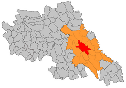
The Iași Metropolitan Area is a metropolitan association in Iași County, Romania, that includes the municipality of Iași and 19 nearby communes.
It has a total surface of 1,159 km² (21.2%) of the 5,476 km² that the county has, and a population of 403,572 inhabitants (52.2%) out of the 772,348 in the county (as per 2011 census).[1]
As defined by Eurostat, with 500,668 residents (as of 2018), the Iași functional urban area is the second most populous in Romania (after Bucharest).[2]
History[]
Iași metropolitan area was constituted on 8 April 2004, to create a better business environment, to attract more consistent investments and to better coordinate environmental and infrastructure projects.
Communities[]
Cities[]
Communes[]
Transportation[]
Major airport[]
| Airport | IATA code | ICAO code |
|---|---|---|
| Iași International Airport | IAS | LRIA |
Major roads[]
- National roads and DN28 (both part of European routes E58 and E583)
References[]
- ^ Jump up to: a b "Population at 2011 Census" (in Romanian). INSSE. Retrieved 7 October 2020.
- ^ Jump up to: a b "Population on 1 January by age groups and sex - functional urban areas". Eurostat. Retrieved 7 October 2020.
External links[]
- Official site
- Population of the Iași metropolitan area: volume, structures and demographic processes
This Iași County location article is a stub. You can help Wikipedia by . |
- Geography of Iași County
- Metropolitan areas of Romania
- Iași County geography stubs