Iara, Cluj
Iara | |
|---|---|
 View of the village of Agriș | |
 Location in Cluj County | |
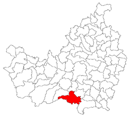
 Iara Location in Romania | |
| Coordinates: 46°33′11″N 23°31′04″E / 46.55306°N 23.51778°ECoordinates: 46°33′11″N 23°31′04″E / 46.55306°N 23.51778°E | |
| Country | Romania |
| County | Cluj |
| Established | 1176 |
| Subdivisions | Agriș, Borzești, Buru, Cacova Ierii, Făgetu Ierii, Iara, Lungești, Măgura Ierii, Mașca, Ocolișel, Surduc, Valea Agrișului, Valea Vadului |
| Government | |
| • Mayor (2020–2024) | Ioan Dorin Popa[1] (PNL) |
| Area | 143.87 km2 (55.55 sq mi) |
| Elevation | 465 m (1,526 ft) |
| Population (2011)[2] | 3,889 |
| • Density | 27/km2 (70/sq mi) |
| Time zone | EET/EEST (UTC+2/+3) |
| Area code | +40 x64 |
| Vehicle reg. | CJ |
| Website | www |

Iara (Hungarian: Alsójára; German: Jahren) is a commune in the southern part of Cluj County, Transylvania, Romania. It is composed of thirteen villages: Agriș (Ruhaegres), Borzești (Berkes), Buru (Borrév), Cacova Ierii (Aranyosivánfalva), Făgetu Ierii (Bikalat), Iara, Lungești (Szurdoklunzsest), Măgura Ierii (Járamagura), Mașca (Macskakő), Ocolișel (Felsőaklos), Surduc (Járaszurdok), Valea Agrișului (Egrespatak) and Valea Vadului (Vádpatak).
Demographics[]
According to the census from 2002, the total population of the commune was 4,704 people. Of this population, 90.68% were ethnic Romanians, 6.01% ethnic Romani and 3.16% are ethnic Hungarians.[3]
References[]
- ^ "Results of the 2020 local elections". Central Electoral Bureau. Retrieved 11 June 2021.
- ^ "Populaţia stabilă pe judeţe, municipii, oraşe şi localităti componenete la RPL_2011" (in Romanian). National Institute of Statistics. Retrieved 4 February 2014.
- ^ http://www.edrc.ro/recensamant.jsp?regiune_id=2140&judet_id=2295&localitate_id=2338

This Cluj County location article is a stub. You can help Wikipedia by . |
Categories:
- Communes in Cluj County
- Localities in Transylvania
- Mining communities in Romania
- Cluj County geography stubs