Icabarú Airport
Icabarú Airport | |||||||||||
|---|---|---|---|---|---|---|---|---|---|---|---|
| Summary | |||||||||||
| Airport type | Public | ||||||||||
| Serves | |||||||||||
| Elevation AMSL | 1,574 ft / 480 m | ||||||||||
| Coordinates | 4°20′15″N 61°44′20″W / 4.33750°N 61.73889°WCoordinates: 4°20′15″N 61°44′20″W / 4.33750°N 61.73889°W | ||||||||||
| Map | |||||||||||
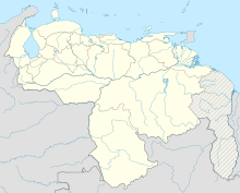
 ICA Location of the airport in Venezuela | |||||||||||
| Runways | |||||||||||
| |||||||||||
Icabarú Airport (IATA: ICA, ICAO: SVIC) is an airport serving the village of in the Bolívar state of Venezuela.
The Icabaru non-directional beacon (Ident: ICA) is located on the field.[3]
See also[]
References[]
- ^ Airport information for ICA at Great Circle Mapper.
- ^ Google Maps - Icabarú
- ^ ICA NDB
External links[]
Categories:
- Airports in Venezuela
- Venezuela stubs
- Venezuelan airport stubs
