Pedernales Airport
Pedernales Airport Pedernales/Capure Delta Amacur Airport | |||||||||||
|---|---|---|---|---|---|---|---|---|---|---|---|
| Summary | |||||||||||
| Airport type | Public | ||||||||||
| Serves | Pedernales | ||||||||||
| Elevation AMSL | 7 ft / 2 m | ||||||||||
| Coordinates | 9°58′40″N 62°14′00″W / 9.97778°N 62.23333°WCoordinates: 9°58′40″N 62°14′00″W / 9.97778°N 62.23333°W | ||||||||||
| Map | |||||||||||
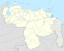
 PDZ Location of the airport in Venezuela | |||||||||||
| Runways | |||||||||||
| |||||||||||
Pedernales Airport (IATA: PDZ, ICAO: SVPE) is an airport serving the village of Pedernales in the Delta Amacuro state of Venezuela.
Boats and the airport are the main access to Pedernales, which is on the estuary of the Caño Manamo River, and has no paved roads leading to it.[2]
See also[]
References[]
- ^ Airport information for PDZ at Great Circle Mapper.
- ^ a b HERE/Nokia - Pedernales
External links[]
Categories:
- Airports in Venezuela
- Venezuela stubs
- Venezuelan airport stubs
