Illingen, Baden-Württemberg
Illingen | |
|---|---|
 | |
 Coat of arms | |
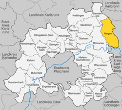
show Location of Illingen within Enzkreis district | |
 Illingen | |
| Coordinates: 48°57′19″N 8°55′8″E / 48.95528°N 8.91889°ECoordinates: 48°57′19″N 8°55′8″E / 48.95528°N 8.91889°E | |
| Country | Germany |
| State | Baden-Württemberg |
| Admin. region | Karlsruhe |
| District | Enzkreis |
| Subdivisions | 2 |
| Area | |
| • Total | 29.36 km2 (11.34 sq mi) |
| Elevation | 235 m (771 ft) |
| Population (2020-12-31)[1] | |
| • Total | 7,739 |
| • Density | 260/km2 (680/sq mi) |
| Time zone | UTC+01:00 (CET) |
| • Summer (DST) | UTC+02:00 (CEST) |
| Postal codes | 75424 75428 |
| Dialling codes | 07042 (Illingen) 07043 (Schützingen) |
| Vehicle registration | PF |
| Website | www |


Illingen is a municipality in Baden-Württemberg, Germany. With a population of about 10,000, it is 27 kilometers (89,000 ft) to the west of Stuttgart, the capital of Baden-Württemberg.
History[]
The towns of Illingen and were, in the Middle Ages, owned by the nearby Maulbronn Monastery. In 1504, the monastery was taken over by the Duchy of Württemberg, beginning a centuries-long association with Württemberg. On 18 March 1806, the now Kingdom of Württemberg assigned Illingen and Schützingen to . This became the district of Maulbronn in 1934, to which the two towns were also assigned. When that district was dissolved in 1938, they were assigned to Vaihingen's district. With the in the State of Baden-Württemberg, they were assigned to the district of Enz. In 1974, Illingen and Schützingen were joined into a single municipality.[2]
Geography[]
The municipality (Gemeinde) of Illingen is located at the eastern edge of the Enzkreis district, within the state of Baden-Württemberg and Federal Republic of Germany. It covers an area of 29.36 square kilometers (11.34 sq mi) that lies within the metropolitan areas of Karlsruhe and Pforzheim. Illingen is physically located on the Keuper Uplands, just north of the Enz valley, between the and the hilly Stromberg region. The largest watercourses within the municipality are the Schmiebach and Metter rivers. The lowest elevation in the municipality, 208 meters (682 ft) NN, lies along the Schmie while the highest, 395 meters (1,296 ft) NN, is the top of the Burgberg in the west.[2]
The geological makeup of Illingen varies by area. The south is composed of Keuper from the Stromberg's Keuperberg subregion. In and around the town of Illingen, this Keuper is covered by layers of loess and loam.[2]
North of Schützingen is the Federally protected nature reserve. In the municipality's southern reaches are the and reserves.[2]
Coat of arms[]
The municipality of Illingen's coat of arms displays the historical coats of arms for the towns of Illingen and Schützingen. On the left is Schützingen's, displaying a red key upon a yellow field, and on the right is Illingen's, a red spear with a golden flag upon a blue field. The flag upon Illingen's dates to 1937 while Schützingen's key was associated with the township by the time of its documentation in the 1684 cartographic book . That municipal coat of arms and flag were approved by the on 1 March 1974.[2]
References[]
- ^ "Bevölkerung nach Nationalität und Geschlecht am 31. Dezember 2020". Statistisches Landesamt Baden-Württemberg (in German). June 2021.
- ^ Jump up to: a b c d e "Illingen". LEO-BW. Baden-Württemberg. Retrieved 7 June 2020.
| show Towns and municipalities in Enz (district) |
|---|
| show Authority control |
|---|
- Municipalities in Baden-Württemberg
- Enzkreis
- Württemberg