Remchingen
show This article may be expanded with text translated from the corresponding article in German. (February 2009) Click [show] for important translation instructions. |
Remchingen | |
|---|---|
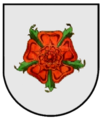
 Coat of arms | |
show Location of Remchingen within Enzkreis district | |
 Remchingen | |
| Coordinates: 48°57′0″N 8°34′35″E / 48.95000°N 8.57639°ECoordinates: 48°57′0″N 8°34′35″E / 48.95000°N 8.57639°E | |
| Country | Germany |
| State | Baden-Württemberg |
| Admin. region | Karlsruhe |
| District | Enzkreis |
| Area | |
| • Total | 24.06 km2 (9.29 sq mi) |
| Elevation | 171 m (561 ft) |
| Population (2020-12-31)[1] | |
| • Total | 11,979 |
| • Density | 500/km2 (1,300/sq mi) |
| Time zone | UTC+01:00 (CET) |
| • Summer (DST) | UTC+02:00 (CEST) |
| Postal codes | 75196 |
| Dialling codes | 07232 |
| Vehicle registration | PF |
| Website | www |


Remchingen (German pronunciation: [ʁe:mçɪŋən] (![]() listen)) is a municipality in the Enz district, in Baden-Württemberg, Germany, situated on the river Pfinz, 14 km southeast of Karlsruhe, and 12 km northwest of Pforzheim.
listen)) is a municipality in the Enz district, in Baden-Württemberg, Germany, situated on the river Pfinz, 14 km southeast of Karlsruhe, and 12 km northwest of Pforzheim.
History[]
Older history[]
- 1st millennium BC: Celtic settlement (grave finds 1947 in Singen)
- Roman settlement between 80 and 90 AD (numerous finds, including two pillars of denial from Nöttingen, two four-god stones immured in the churches of Nöttingen, inscription plate from the settlement Vicus Senotensis)
- After the Romans fled their flight around 260 AD, the Alamanni settled the land to the right of the Rhine, but a little over two centuries later, after a great battle in 496, they were forced by the Franconian tribe to give up the Kraichgau and the landscape up to vacate the Murg.
- The first written mentions of Remchingen districts date from the 8th century: On June 1, 769 in “Sigincheim im Pfinzgau” (first mention of Singen), four Franks gave Lorsch monastery a farmyard, 34 acres of arable land, a meadow and a piece of forest . Between 888 and 893, the abbot of this monastery exchanged further ownership of this monastery in "Vulvirincha", today's Wilferdingen, for the same area in Illingen, southeast of Maulbronn (Wilferdingen is mentioned for the first time).
- Around 825 a certain Noting, probably related to the Counts of Calw, gave the Reichenau monastery goods in Nöttingen, Dietenhausen and Singen, which at that time, like the entire northern Pfinztal, were in the Ufgau, according to a source from the 16th century.
- 1160: First mention of the Lords of Remchingen, a lower nobility family. They probably built a moated castle, Remchingen Castle, out of wood on the site of today's open-air swimming pool.
- 1278: Darmsbach is mentioned for the first time, a settlement that only developed in the High Middle Ages
- shortly after 1300: The Lords of Remchingen sold their moated castle. They later bought back shares in the castle for a while, but then finally sold them to the Margraves of Baden in 1568.
- Around 1460, the pilgrimage chapel of our dear Frau zur Eich was built near today's Sperlingshof, but was abandoned again between 1520 and 1540. In 1568 rights to the former chapel were transferred from the Herrenalb monastery to the margraviate of Baden-Durlach. From the former buildings (chapel and outbuildings) only artefacts in the “monastery” are evidence of today. [8]
- 16th century: Nöttingen, Singen and Wilferdingen took part in the Bundschuh rebellion (1502) and the Peasants' War (1525)
- April 14, 1604: Margrave Ernst Friedrich von Baden died of a blow in a Calvinist-Lutheran religious war against Pforzheim near Remchingen Castle. The trigger for the dispute was the Staffort book of 1599 and the earlier relocation of the Baden residence to Durlach.
19th and 20th centuries[]
- July 12, 1806: Foundation of the Grand Duchy of Baden
- 1861: Nöttingen successfully fought against the railway connection on the Karlsruhe – Mühlacker line, which then took place via Wilferdingen-Singen.
- March 21, 1919: Constitution of the Democratic Republic of Baden came into force
- June 25, 1939: Foundation of the Pforzheim district
- 1945: part of the American zone of occupation
- September 19, 1945: Foundation of the state of Württemberg-Baden
- April 25, 1952: Foundation of the state of Baden-Württemberg
- January 1, 1973 Foundation of the Enzkreis in accordance with the district reform in Baden-Württemberg
Reforms[]
The municipality of Remchingen was formed on January 1, 1973 through the merger of the two municipalities of Singen and Wilferdingen. The name of the former lords of "Remchingen" is chosen as the place name of the new community.
On January 1, 1975, the community of Nöttingen was incorporated into Remchingen.
No local councils have been set up, the districts are represented in different degrees in the local council.
Population development[]
| Year | Population |
|---|---|
| 1939 | 3.913 |
| 1959 | 5.096 |
| 1961 | 6.054 |
| 1970 | 7.650 |
| 1987 | 9.409 |
| 2000 | 11.407 |
| 2005 | 11.655 |
| 2008 | 11.846 |
| 2010 | 11.713 |
| 2013 | 11.698 |
| 2015 | 11.695 |
| 2016 | 11.943 |
| 2017 | 11.855 |
| 2018 | 11.773 |
| 2019 | 11.998 |
| 2020 | 12.055 |
Coat of arm[]
Description: Two silver crossed glaive poles in red covered with a silver shield, inside a green-tipped red rose with blue clusters.
Old coats of arms[]
Before Remchingen came into being, there were the communities of Wilferdingen, Singen and Darmsbach, all of which had their own coat of arms. The coat of arms of Wilferdingen was then adopted.

Wilferdingen

Singen
Nöttingen


Geography[]
Remchingen consists of the former municipalities Nöttingen, Wilferdingen and Singen. Remchingen was originally formed on 1 January 1973 by the merging of the municipalities Wilferdingen and Singen with Nöttingen also being included on 1 January 1975.
Neighbouring municipalities are Pfinztal, Königsbach-Stein, Kämpfelbach, Keltern and Karlsbad.
Climate[]
Remchingen has a relatively mild climate. This is characterized by the Pfinztal and the Rhine valley.
| January | February | March | April | May | June | July | August | September | October | November | December | |
|---|---|---|---|---|---|---|---|---|---|---|---|---|
| ø. temperature (°C) | 0.9 | 2.4 | 6 | 10 | 14.2 | 17.4 | 19.3 | 18.7 | 15.8 | 10.6 | 5.4 | 2.1 |
| Min. temperature (°C) | -1.7 | -0.8 | 1.6 | 4.9 | 8.7 | 12.1 | 13.8 | 13.3 | 10.5 | 6.3 | 2.3 | -0.5 |
| Max. temperature (°C) | 3.6 | 5.7 | 10.5 | 15.2 | 19.7 | 22.8 | 24.9 | 24.2 | 21.1 | 15 | 8.5 | 4.7 |
| Precipitation (mm) | 49 | 49 | 45 | 56 | 73 | 86 | 71 | 74 | 57 | 51 | 61 | 56 |
Source: climate-data.org[2]
Sister cities, twin towns and friendship agreements[]
Remchingen has sister city agreements with the following cities:
 San Biagio Platani in Italy
 Sisak, Croatia.
Approximately 300 Sanbiagesi along with their families now live in Remchingen as well as another 100 former residents of Remchingen can be found in San Biagio Platani having returned to their hometown.[3]
Structure and districts[]
Remchingen is made up of four districts. The four districts are very dense and central. The largest district is Wilferdingen. It is centrally located in the middle of Remchingen. This is where most of the infrastructure and the town center can be found. Singen is on the northern side in the direction of Karlsruhe. Singen is the second largest district and is right next to Wilferdingen. Nöttingen is the third largest and southernmost district. Darmsbach, by far the smallest district of Remchingen, lies between Nöttingen and Wilferdingen. All four districts are very close to each other and can be reached very quickly.
Population distribution[]
- Wilferdingen (5218 inhabitants)
- Singen (3807 inhabitants)
- Nöttingen (2434 inhabitants)
- (558 inhabitants)
Politics[]
Local council[]
The municipal council consists of 22 elected honorary councilors and the mayor as chairman. The mayor is entitled to vote in the municipal council.
The local elections was on May 29, 2019.[4]
| Party | Result | Seats | Results 2014 | |
| Christian Democratic Union of Germany | 35,1 % | 8 | 45,5 %, 10 Seats | |
| Free Voters | 19,7 % | 4 | 24,9 %, 5 Seats | |
| Alliance 90/The Greens | 16,4 % | 4 | 8,9 %, 2 Seats | |
| Social Democratic Party of Germany | 14,0 % | 3 | 20,6 %, 5 Seats | |
| Citizens list for the environment, transparency and progress | 14,8 % | 3 | – |
The turnout in 2019 was 63.4% (2014: 52.4%).
Mayor[]
In November 2009, Luca Wilhelm Prayon was elected the new mayor with 68.7 percent of the valid votes in the first ballot; he was re-elected in 2017 with 96% and a 34% turnout.[5]
Partys[]
In Remchingen there are local groups of several parties:
- The Christian Democratic Union of Germany (CDU),
- Alliance 90/The Greens,
- the Social Democratic Party of Germany (SPD),
- the Free Voters,
- the local party Citizens List for Environment, Transparency and Progress,
- the Free Democratic Party (FDP),
- the Alternative for Germany (AfD) and
- the party Die PARTEI.[6]
Economy and infrastructure[]
Infrastructure[]
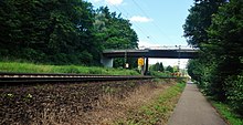
Railway[]

Remchingen is situated on the Karlsruhe-Mühlacker railway. The Wilferdingen-Singen station is the railway station in Remchingen. The Karlsruhe Stadtbahn drives to the station with the lines S5 and S51. It connects the station with Karlsruhe and Pforzheim. The trains come every 30 minutes. In addition, the IRE1 line stops in Remchingen every two hours. The regional train RB17a stops twice in the morning. It connects Remchingen with Karlsruhe, Heidelberg and Stuttgart.
Bus[]
There are 22 bus stops in Remchingen. The central point is the bus station at the train station. Lines 722 and 721 connect Remchingen with Pforzheim.
Car[]
The Bundesstraße 10 and the Bundesautobahn 8 link the municipality to the national road network.
Education[]
In Remchingen you can find a Realschule (Carl-Dittler-Realschule) in Wilferdingen. Further more there is a Gymnasium and an elementary school and a Hauptschule with Werkrealschule in Singen. There are other elementary schools in Wilferdingen and Nöttingen.
| type of school | students |
|---|---|
| Elementary school | 441 |
| Werkreal-/Hauptschulen (secondary school) | 189 |
| Realschulen (secondary school) | 369 |
| Gymnasium (secondary school) | 480 |
| Special education | 30 |
| Total | 1.509 |
Culture and sights[]

Remchingen is located on Bertha Benz Memorial Route which leads from Mannheim to Pforzheim. Johann Gottfried Tulla, who got known for straightening the river Rhine, grew up in Nöttingen.

Museums[]
The Roman Museum Remchingen (German: Römermuseum Remchingen) is in Remchingen-Wilferdingen. There is an old Roman house and many finds from Remchingen to see. The telephone booth museum (German: Telefonzellenmuseum) is on the railroad tracks. There are many telephones and telephone booths there.
Excavations[]
Discoveries of remains from the Roman Empire were made in and around the church of Nöttingen, which can partly be seen in the church and in a museum in Karlsruhe.
In the development area "Niemandsberg" in Wilferdingen an archeological excavation of a Roman farm can be found, which was turned into a museum.
Sports[]
The football club FC Nöttingen played in the Fußball-Regionalliga in 2004, which was the third highest football league in Germany at that time. Currently they are playing in the Fußball-Oberliga Baden-Württemberg.
Other clubs in Remchingen are FC Germania Singen and FC Alemannia Wilferdingen.
Music[]
The Folk-Punk-Band Across the Border is from Remchingen. The musician Max Giesinger is from Remchingen too.
Notable people from Remchingen[]
- Gottfried Leonhard (1895–1983), politician (CDU)
- Johann Gottfried Tulla (1770–1828), engineer; known for straightening the Rhine; grew up in Remchingen-Nöttingen,
- Max Giesinger (born 1988), singer, songwriter and music producer, grew up partially in Remchingen,
- Simon Gegenheimer (born 1988), mountain biker and two-time vice world champion, was born in remchingen and lives there.
- Jeff S. Klotz (born 1990), Author, publisher, museum director and entrpreneur
References[]
- ^ "Bevölkerung nach Nationalität und Geschlecht am 31. Dezember 2020". Statistisches Landesamt Baden-Württemberg (in German). June 2021.
- ^ https://de.climate-data.org/location/22196/ Klima Remchingen (Deutschland), auf de.climate-data.org
- ^ webcontact.de. "Remchingen: Partnergemeinde". www.remchingen.de. Retrieved 2016-09-20.
- ^ "Gemeinderatswahlen 2019 - Statistisches Landesamt Baden-Württemberg". www.statistik-bw.de. Retrieved 2021-04-12.
- ^ "Luca Wilhelm Prayon in Remchingen mit 96 Prozent erneut zum Bürgermeister gewählt - Region - Pforzheimer-Zeitung". Pforzheimer Zeitung (in German). Retrieved 2021-04-12.
- ^ "Remchingen: Parteien". www.remchingen.de. Retrieved 2021-04-12.
External links[]
- Official Webpage
- Bertha Benz Memorial Route (in English)
| show Towns and municipalities in Enz (district) |
|---|
| show Authority control |
|---|
- Municipalities in Baden-Württemberg
- Enzkreis
- Baden