Illinois Territory's at-large congressional district
This article needs additional citations for verification. (September 2018) |
| Illinois Territory's at-large congressional district | |||
|---|---|---|---|
| Obsolete district | |||
| |||
| Created | 1812, as a non-voting delegate was granted by Congress | ||
| Eliminated | 1818, as a result of statehood | ||
| Years active | 1812–1818 | ||

Illinois Territory's at-large congressional district was a congressional district that encompassed the entire Illinois Territory. The territory was established on March 1, 1809 from portions of Indiana Territory. The district elected a non-voting delegate to the United States House of Representatives.
List of delegates representing the district[]
| Delegate (Residence) |
Party | Years | Cong ress |
Electoral history |
|---|---|---|---|---|
 Shadrach Bond (Kaskaskia) |
Democratic-Republican[1] | December 3, 1812 – August 2, 1813 |
12th 13th |
. [data unknown/missing] |
| Vacant | August 2, 1813 – November 14, 1814 |
13th | ||
 Benjamin Stephenson (Edwardsville)[2] |
Democratic-Republican[2] | November 14, 1814 – March 3, 1817 |
13th 14th |
Elected to finish Bond's term. [data unknown/missing] Retired. |
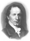
 Nathaniel Pope (Kaskaskia) |
Democratic-Republican[3] | March 4, 1817 – November 30, 1818 |
15th | Elected in 1816. Statehood achieved. |
Statehood[]
On April 18, 1818, Congress passed an act that enabled the people of Illinois Territory to begin the process of forming a state. As part of that act, Illinois Territory was reduced in size to the boundaries of the present state. The remainder of what had been Illinois Territory was attached to Michigan Territory. The state of Illinois was accepted into the Union on December 3, 1818.
References[]
- ^ Sobel, Robert; Raimo, John (1978). Biographical Directory of the Governors of the United States, 1789-1978. 1. Westport, CT: Meckler Books. p. 365.
- ^ a b Norton, William T. (1912). Centennial History of Madison County, Illinois, and Its People, 1812 to 1912. Chicago, IL: Lewis Publishing Company. p. 88.
- ^ Lusk, David W. (1887). Politics and Politicians of Illinois. Springfield, IL: H. W. Rokker. p. 377.
See also[]
- Northwest Territory's at-large congressional district
- Wisconsin Territory's at-large congressional district
- Michigan Territory's at-large congressional district
- Minnesota Territory's at-large congressional district
Coordinates: 41°48′N 89°22′W / 41.80°N 89.36°W

This United States Congress–related article is a stub. You can help Wikipedia by . |
- Congressional districts of Illinois
- Obsolete United States congressional districts
- At-large United States congressional districts
- Constituencies established in 1812
- 1812 establishments in Illinois Territory
- Constituencies disestablished in 1818
- 1818 disestablishments in Illinois Territory
- United States Congress stubs