Interstate 69W
 | ||||
|---|---|---|---|---|
 I-69W highlighted in red. | ||||
| Route information | ||||
| Auxiliary route of I-69 | ||||
| Maintained by TxDOT | ||||
| Length | 1.436 mi[2] (2.311 km) | |||
| Existed | June 26, 2014[1]–present | |||
| Major junctions | ||||
| South end | World Trade Bridge Port of Entry in Laredo | |||
| North end | ||||
| Location | ||||
| Counties | Webb | |||
| Highway system | ||||
| ||||
Interstate 69W (I-69W) is a relatively short north–south Interstate Highway running through South Texas in the United States. The freeway begins northeast of the middle of World Trade International Bridge in Laredo and ends at I-35. In the future, I-69W will head northeast for 180 miles (290 km) before terminating near Victoria as both I-69E and I-69W merge to form I-69. For its entire length, I-69W runs concurrently with US Highway 59 (US 59).
Route description[]
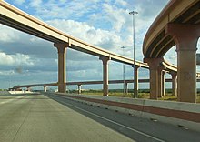
The Federal Highway Administration (FHWA) approved the designation of a 1.4-mile (2.3 km) section of freeway in Laredo as part of I-69W. The congressionally designated I-69W corridor begins at the Mexican border on the World Trade International Bridge, which connects to Mexican Federal Highway 85D, at the border in Laredo. It is co-signed with both US 59 and Loop 20 (Bob Bullock Loop) and extends 1.4 miles (2.3 km) to I-35 (which connects to Mexican Federal Highway 85 south of the border).[1]
In the future, I-69W will continue along US 59 east to George West, where it will intersect I-69C, it will then intersect I-37 east of George West, and it will then continue east to Victoria, where it will meet with I-69E, and continue towards Houston as I-69. The completed I-69W will measure 180 miles (290 km). There are also plans to turn State Highway 44 (SH 44) into an Interstate Highway between Freer, where it will intersect I-69W, and Corpus Christi, about 73 miles (117 km) in order to have a network of Interstate Highways connecting Laredo, the largest inland port on the United States–Mexican border, with Corpus Christi, a major seaport and manufacturing center.[3]
History[]
The Intermodal Surface Transportation Efficiency Act of 1991 included two High Priority Corridors that would later become parts of a proposed cross-country extension of I-69:
- (18) Corridor from Indianapolis, Indiana, to Memphis, Tennessee, via Evansville, Indiana.
- (20) US 59 Corridor from Laredo, Texas, through Houston, to the vicinity of Texarkana, Texas.[4]
The National Highway System Designation Act of 1995 made further amendments to the description of Corridor 18, specifying that it would serve Mississippi and Arkansas, extending it south to the Mexican border in the Lower Rio Grande Valley, and adding a short connection at Brownsville, Texas. This act also specified that Corridors 18 and 20 were "future parts of the Interstate System", to become actual Interstates when built to Interstate standards and connected to other Interstates.[5]
The Transportation Equity Act for the 21st Century (TEA-21), enacted in 1998, greatly expanded the extension to the Lower Rio Grande Valley was detailed as splitting into two routes just south of Victoria, one following US 77 and the other following US 59 and US 281 to the Rio Grande. This act also assigned the I-69 designation to Corridors 18 and 20, with the branches on US 77, US 281, and US 59 to the Rio Grande being "Interstate 69 East", "Interstate 69 Central", and "Interstate 69 West", respectively.[6] With TEA-21, the I-69 extension took shape, and remains today as those segments.[7]
Exit list[]
The entire route is in Laredo, Webb County. All exits are unnumbered.
| mi[2] | km | Destinations | Notes | |||
|---|---|---|---|---|---|---|
| 0.000 | 0.000 | To World Trade International Bridge | Bridge over Rio Grande to Mexico; termini of I-69W / US 59 / Loop 20 | |||
| World Trade Bridge Port of Entry | ||||||
| 0.245– 1.169 | 0.394– 1.881 | |||||
| 1.368– 1.436 | 2.202– 2.311 | Exit 8A on I-35 / US 83 | ||||
| US 59 / Loop 20 continue east as Bob Bullock Loop; future I-69W | ||||||
1.000 mi = 1.609 km; 1.000 km = 0.621 mi
| ||||||
See also[]
 Texas portal
 U.S. Roads portal
References[]
- ^ a b Koch, James W. & Weber, Joe (June 26, 2014). "Minute Order" (PDF). Texas Transportation Commission. Retrieved July 30, 2014.
- ^ a b Texas Department of Transportation (2018). "Statewide Planning Map LRS Readout (ArcGIS)". Retrieved October 4, 2019.
- ^ "Push on to Add SH 44 to I-69 Priority Corridor System" (Press release). Alliance for I-69 Texas. April 30, 2014. Retrieved August 2, 2014.
- ^ "H.R.2950". Thomas. Library of Congress. Archived from the original on December 15, 2012. Retrieved January 13, 2012.
- ^ "S.440". Thomas. Library of Congress. February 16, 1995. Archived from the original on September 4, 2015. Retrieved January 13, 2012.
- ^ "H.R. 2400". Thomas. Library of Congress. Archived from the original on December 16, 2012. Retrieved January 13, 2012.
- ^ Staff. "NHS High Priority Corridors Description". Federal Highway Administration. Archived from the original on February 7, 2008. Retrieved August 2007. Check date values in:
|access-date=(help)
External links[]
Route map:

| ( • help)
|
- Interstate 69
- U.S. Route 59
- Interstate Highways in Texas
- Transportation in Bee County, Texas
- Transportation in Duval County, Texas
- Transportation in Goliad County, Texas
- Transportation in Live Oak County, Texas
- Transportation in McMullen County, Texas
- Transportation in Victoria County, Texas
- Transportation in Webb County, Texas