Iowa Falls, Iowa
Iowa Falls, Iowa | |
|---|---|
 | |
| Nickname(s): The Scenic City | |
 Location of Iowa Falls, Iowa | |
| Coordinates: 42°31′N 93°16′W / 42.517°N 93.267°WCoordinates: 42°31′N 93°16′W / 42.517°N 93.267°W | |
| Country | |
| State | |
| County | Hardin |
| Area | |
| • Total | 5.46 sq mi (14.14 km2) |
| • Land | 5.38 sq mi (13.94 km2) |
| • Water | 0.08 sq mi (0.20 km2) |
| Elevation | 1,106 ft (337 m) |
| Population | |
| • Total | 5,106 |
| • Density | 935.2/sq mi (361.10/km2) |
| Time zone | UTC-6 (Central (CST)) |
| • Summer (DST) | UTC-5 (CDT) |
| ZIP code | 50126 |
| Area code(s) | 641 |
| FIPS code | 19-38640 |
| GNIS feature ID | 0457829 |
| Website | www.cityofiowafalls.com |

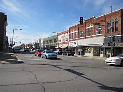
Iowa Falls is a city in Hardin County, Iowa, United States. Iowa Falls is the home of Ellsworth Community College. It is also a regional transportation center, located along U.S. Routes 20 and 65 and the Canadian National and Union Pacific Railroads. The population was 5,106 at the time of the 2020 census.[2] A landmark in the city is its movie theater. Built as the Metropolitan Opera House in 1899, it presented plays, operas, and vaudeville in the town during the first half of the twentieth century, and today is listed on the National Register of Historic Places.
History[]
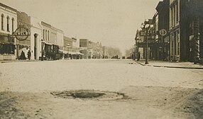
Iowa Falls was laid out and platted in 1856.[3] It was named from the falls on the Iowa River.[4]
The Illinois Central Railroad was built through Iowa Falls in 1866.[5]
Geography[]
Iowa Falls is located at 42°31′N 93°16′W / 42.517°N 93.267°W (42.5221, -93.2673).[6]
According to the United States Census Bureau, the city has a total area of 5.44 square miles (14.09 km2), of which 5.36 square miles (13.88 km2) is land and 0.08 square miles (0.21 km2) is water.[7]
Demographics[]
| Year | Pop. | ±% |
|---|---|---|
| 1880 | 955 | — |
| 1890 | 1,796 | +88.1% |
| 1900 | 2,840 | +58.1% |
| 1910 | 2,797 | −1.5% |
| 1920 | 3,954 | +41.4% |
| 1930 | 4,112 | +4.0% |
| 1940 | 4,425 | +7.6% |
| 1950 | 4,900 | +10.7% |
| 1960 | 5,565 | +13.6% |
| 1970 | 6,454 | +16.0% |
| 1980 | 6,174 | −4.3% |
| 1990 | 5,435 | −12.0% |
| 2000 | 5,193 | −4.5% |
| 2010 | 5,238 | +0.9% |
| 2020 | 5,106 | −2.5% |
| Source:"U.S. Census website". United States Census Bureau. Retrieved 2020-03-29. and Iowa Data Center Source: | ||
2010 census[]
At the 2010 census there were 5,238 people, 2,207 households, and 1,295 families living in the city. The population density was 977.2 inhabitants per square mile (377.3/km2). There were 2,462 housing units at an average density of 459.3 per square mile (177.3/km2). The racial makup of the city was 94.0% White, 2.7% African American, 0.4% Native American, 0.7% Asian, 1.0% from other races, and 1.1% from two or more races. Hispanic or Latino of any race were 3.9%.[9]
Of the 2,207 households 26.8% had children under the age of 18 living with them, 44.0% were married couples living together, 10.6% had a female householder with no husband present, 4.1% had a male householder with no wife present, and 41.3% were non-families. 37.1% of households were one person and 18.9% were one person aged 65 or older. The average household size was 2.17 and the average family size was 2.81.
The median age was 40.9 years. 21.2% of residents were under the age of 18; 12.6% were between the ages of 18 and 24; 20.2% were from 25 to 44; 23.6% were from 45 to 64; and 22.4% were 65 or older. The gender makeup of the city was 48.2% male and 51.8% female.
2000 census[]
At the 2000 census there were 5,193 people, 2,215 households, and 1,331 families living in the city. The population density was 1,043.1 people per square mile (402.6/km2). There were 2,412 housing units at an average density of 484.5 per square mile (187.0/km2). The racial makup of the city was 97.34% White, 1.21% African American, 0.15% Native American, 0.33% Asian, 0.42% from other races, and 0.54% from two or more races. Hispanic or Latino of any race were 1.04%.[10]
Of the 2,215 households 25.4% had children under the age of 18 living with them, 48.9% were married couples living together, 8.3% had a female householder with no husband present, and 39.9% were non-families. 34.6% of households were one person and 18.5% were one person aged 65 or older. The average household size was 2.19 and the average family size was 2.81.
The age distribution was20.3% under the age of 18, 13.0% from 18 to 24, 22.2% from 25 to 44, 21.5% from 45 to 64, and 23.1% that were 65 or older. The median age was 41 years. For every 100 females, there were 89.5 males. For every 100 females age 18 and over, there were 85.0 males.
The median household income was $32,141 and the median family income was $42,279. Males had a median income of $31,216 versus $21,004 for females. The per capita income for the city was $18,330. About 7.1% of families and 10.0% of the population were below the poverty line, including 12.5% of those under age 18 and 8.3% of those age 65 or over.
Radio stations[]
KIFG (Iowa River Radio) 95.3 FM, 1510 AM
Education[]
Iowa Falls Community School District operates public schools.
Cable broadcasting[]
This section does not cite any sources. (August 2007) |
An over-the-air cable system existed in Iowa Falls, similar to one in Iron Mountain, Michigan. A list of channels and what they rebroadcast:
|
|
|
Notable people[]
- Nick Collison, Basketball player
- Joseph Gomer, Tuskegee Airman
- Kurt Ploeger, former NFL player
- Bill Riley, Sr., Television personality
- Randy Schultz former NFL player
- Jim Trickey, Football player
- Christopher Whitesell, Writer
- Jim Whitesell, Basketball Coach
- John Whitesell, Hollywood Director
- Patrick Whitesell, Hollywood agent and co-CEO of WME Entertainment
- Sean Whitesell, Actor, Writer, Producer
See also[]
- National Register of Historic Places listings in Hardin County, Iowa
- St. Matthew's by the Bridge Episcopal Church
- Metropolitan Opera House (Iowa Falls, Iowa)
References[]
- ^ "2019 U.S. Gazetteer Files". United States Census Bureau. Retrieved July 17, 2020.
- ^ Jump up to: a b c "2020 Census State Redistricting Data". census.gov. United states Census Bureau. Retrieved 12 August 2021.
- ^ History of Hardin County, Iowa. Union Publishing Company. 1883. pp. 732.
- ^ Gannett, Henry (1905). The Origin of Certain Place Names in the United States. Govt. Print. Off. pp. 165.
- ^ Moir, William J. (1911). Past and Present of Hardin County, Iowa. Unigraphic. pp. 250.
- ^ "US Gazetteer files: 2010, 2000, and 1990". United States Census Bureau. 2011-02-12. Retrieved 2011-04-23.
- ^ "US Gazetteer files 2010". United States Census Bureau. Archived from the original on 2012-07-02. Retrieved 2012-05-11.
- ^ "Census of Population and Housing". Census.gov. Retrieved June 4, 2015.
- ^ "U.S. Census website". United States Census Bureau. Retrieved 2012-05-11.
- ^ "U.S. Census website". United States Census Bureau. Retrieved 2008-01-31.
External links[]
| Wikimedia Commons has media related to Iowa Falls, Iowa. |
| show Municipalities and communities of Hardin County, Iowa, United States |
|---|
| show Authority control |
|---|
- Iowa Falls, Iowa
- Cities in Iowa
- Cities in Hardin County, Iowa
- 1856 establishments in Iowa