Iron Junction, Minnesota
Iron Junction | |
|---|---|
City | |
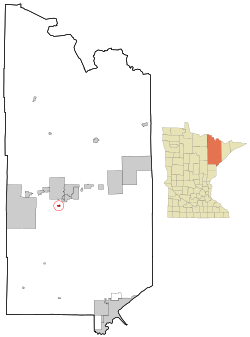 Location of the city of Iron Junction within Saint Louis County, Minnesota | |
| Coordinates: 47°25′1″N 92°36′16″W / 47.41694°N 92.60444°W | |
| Country | United States |
| State | Minnesota |
| County | Saint Louis |
| Area | |
| • Total | 0.81 sq mi (2.10 km2) |
| • Land | 0.81 sq mi (2.10 km2) |
| ��� Water | 0.00 sq mi (0.00 km2) |
| Elevation | 1,388 ft (423 m) |
| Population | |
| • Total | 86 |
| • Estimate (2019)[3] | 86 |
| • Density | 105.91/sq mi (40.88/km2) |
| Time zone | UTC-6 (Central (CST)) |
| • Summer (DST) | UTC-5 (CDT) |
| ZIP codes | 55751 |
| Area code(s) | 218 |
| FIPS code | 27-31238[4] |
| GNIS feature ID | 0661552[5] |

Iron Junction is a city in Saint Louis County, Minnesota, United States. The population was 86 at the 2010 census.[6]
Saint Louis County Highway 7 and Iron Junction Road serve as main routes in the community. State Highway 37 (MN 37) is nearby.
The name Iron Junction, as a place of residence, is seldom used today by its residents. Those who reside in this community simply identify themselves as a resident of Iron. The road signs posted in the community also simply read "Iron".[citation needed]
The city of Iron Junction is located within Clinton Township geographically but is a separate entity.
Geography[]
According to the United States Census Bureau, the city has a total area of 0.83 square miles (2.15 km2), all land.[7]
Demographics[]
| Historical population | |||
|---|---|---|---|
| Census | Pop. | %± | |
| 1900 | 118 | — | |
| 1910 | 76 | −35.6% | |
| 1920 | 92 | 21.1% | |
| 1930 | 128 | 39.1% | |
| 1940 | 107 | −16.4% | |
| 1950 | 128 | 19.6% | |
| 1960 | 187 | 46.1% | |
| 1970 | 150 | −19.8% | |
| 1980 | 134 | −10.7% | |
| 1990 | 133 | −0.7% | |
| 2000 | 93 | −30.1% | |
| 2010 | 86 | −7.5% | |
| 2019 (est.) | 86 | [3] | 0.0% |
| U.S. Decennial Census[8] | |||
2010 census[]
As of the census[2] of 2010, there were 86 people, 45 households, and 24 families living in the city. The population density was 103.6 inhabitants per square mile (40.0/km2). There were 47 housing units at an average density of 56.6 per square mile (21.9/km2). The racial makeup of the city was 96.5% White, 1.2% from other races, and 2.3% from two or more races. Hispanic or Latino of any race were 2.3% of the population.
There were 45 households, of which 15.6% had children under the age of 18 living with them, 42.2% were married couples living together, 2.2% had a female householder with no husband present, 8.9% had a male householder with no wife present, and 46.7% were non-families. 37.8% of all households were made up of individuals, and 11.1% had someone living alone who was 65 years of age or older. The average household size was 1.91 and the average family size was 2.42.
The median age in the city was 53.5 years. 12.8% of residents were under the age of 18; 4.6% were between the ages of 18 and 24; 16.3% were from 25 to 44; 45.4% were from 45 to 64; and 20.9% were 65 years of age or older. The gender makeup of the city was 54.7% male and 45.3% female.
2000 census[]
As of the census of 2000,[4] there were 93 people, 44 households, and 31 families living in the city. The population density was 119.3 people per square mile (46.0/km2). There were 44 housing units at an average density of 56.4 per square mile (21.8/km2). The racial makeup of the city was 100.00% White. 26.5% were of Norwegian, 14.7% Finnish, 13.2% German, 11.8% Swedish, 8.8% Slovene and 5.9% French Canadian ancestry.
There were 44 households, out of which 20.5% had children under the age of 18 living with them, 61.4% were married couples living together, 2.3% had a female householder with no husband present, and 29.5% were non-families. 25.0% of all households were made up of individuals, and 9.1% had someone living alone who was 65 years of age or older. The average household size was 2.11 and the average family size was 2.52.
In the city, the population was spread out, with 14.0% under the age of 18, 5.4% from 18 to 24, 26.9% from 25 to 44, 30.1% from 45 to 64, and 23.7% who were 65 years of age or older. The median age was 47 years. For every 100 females, there were 126.8 males. For every 100 females age 18 and over, there were 122.2 males.
The median income for a household in the city was $40,938, and the median income for a family was $45,625. Males had a median income of $39,375 versus $31,875 for females. The per capita income for the city was $21,751. None of the population and none of the families were below the poverty line.
Coordinates: 47°25′08″N 92°36′13″W / 47.41889°N 92.60361°W
References[]
- ^ "2019 U.S. Gazetteer Files". United States Census Bureau. Retrieved July 26, 2020.
- ^ Jump up to: a b "U.S. Census website". United States Census Bureau. Retrieved 2012-11-13.
- ^ Jump up to: a b "Population and Housing Unit Estimates". United States Census Bureau. May 24, 2020. Retrieved May 27, 2020.
- ^ Jump up to: a b "U.S. Census website". United States Census Bureau. Retrieved 2008-01-31.
- ^ "US Board on Geographic Names". United States Geological Survey. 2007-10-25. Retrieved 2008-01-31.
- ^ "2010 Census Redistricting Data (Public Law 94-171) Summary File". American FactFinder. U.S. Census Bureau, 2010 Census. Retrieved 23 April 2011.[dead link]
- ^ "US Gazetteer files 2010". United States Census Bureau. Archived from the original on 2012-07-02. Retrieved 2012-11-13.
- ^ "Census of Population and Housing". Census.gov. Retrieved June 4, 2015.

- Cities in Minnesota
- Cities in St. Louis County, Minnesota