Itapecerica da Serra
Itapecerica da Serra | |
|---|---|
Municipality | |
 | |
 Flag  Coat of arms | |
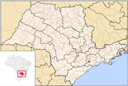 Location in São Paulo state | |
 Itapecerica da Serra Location in Brazil | |
| Coordinates: 23°43′2″S 46°50′58″W / 23.71722°S 46.84944°WCoordinates: 23°43′2″S 46°50′58″W / 23.71722°S 46.84944°W | |
| Country | |
| Region | Southeast Brazil |
| State | São Paulo |
| Metropolitan Region | São Paulo |
| Area | |
| • Total | 150.74 km2 (58.20 sq mi) |
| Elevation | 920 m (3,020 ft) |
| Population (2020 [1]) | |
| • Total | 177,662 |
| ��� Density | 1,200/km2 (3,100/sq mi) |
| Time zone | UTC-3 (BRT) |
| • Summer (DST) | UTC-2 (BRST) |

Itapecerica da Serra is a municipality in the state of São Paulo in Brazil. It is part of the Metropolitan Region of São Paulo.[2] The population is 177,662 (2020 est.) in an area of 150.74 km².[3] It is located 23 miles southwest of São Paulo and at an altitude of 920m above sea level. The name Itapecerica is believed to come from the Tupi language for slippery stone, and da Serra means of the Mountains in Portuguese.
History[]
Itapecerica da Serra was founded in 1562 by the Jesuit missionaries. It was one of several settlements Christianized indians, established around the Colégio de São Paulo de Piratininga (later to become the city of São Paulo) as a first line of defense against raids by hostile Indians. Besides the local inhabitants, the village incorporated natives from the village of Carapicuíba, brought by bandeirante and priest .
References[]
| show Places adjacent to Itapecerica da Serra |
|---|
External links[]
| show Authority control |
|---|
This geographical article relating to the state of São Paulo is a stub. You can help Wikipedia by . |
- Municipalities in São Paulo (state)
- Populated places established in 1562
- São Paulo (state) geography stubs