Santana de Parnaíba
Santana de Parnaíba | |
|---|---|
Municipality | |
 Church in Santana de Parnaíba | |
 Flag  Coat of arms | |
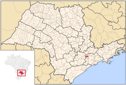 Location in São Paulo state | |
 Santana de Parnaíba Location in Brazil | |
| Coordinates: 23°26′38″S 46°55′4″W / 23.44389°S 46.91778°WCoordinates: 23°26′38″S 46°55′4″W / 23.44389°S 46.91778°W | |
| Country | |
| Region | Southeast Brazil |
| State | São Paulo |
| Metropolitan Region | São Paulo |
| Area | |
| • Total | 179.95 km2 (69.48 sq mi) |
| Population (2020 [1]) | |
| • Total | 142,301 |
| • Density | 790/km2 (2,000/sq mi) |
| Time zone | UTC-3 (BRT) |
| • Summer (DST) | UTC-2 (BRST) |

Santana de Parnaíba is a city and municipality in the state of São Paulo in Brazil. It is part of the Metropolitan Region of São Paulo.[2] The population is 142,301 (2020 est.) in an area of 179.95 km2 (69.48 sq mi).[3] It was founded in 1625 near the Tietê River by Susana Dias, an important Bandeirante (Brazilian pioneers) wife. It was the birthplace of prominent Bandeirante Domingos Jorge Velho.
The word Parnaíba means rocky river.
The municipality contains and administers the 367-hectare (910-acre) Tamboré Biological Reserve, a strictly protected conservation unit.[4]

Old center of Santana de Parnaíba
References[]
- ^ IBGE 2020
- ^ Lei Complementar nº 1.139, de 16 de junho de 2011
- ^ Instituto Brasileiro de Geografia e Estatística
- ^ O que é a Reserva? (in Portuguese), Brookfield Institute, retrieved 19 April 2016
| show Authority control |
|---|
This geographical article relating to the state of São Paulo is a stub. You can help Wikipedia by . |
Categories:
- Municipalities in São Paulo (state)
- Populated places established in 1625
- 1625 establishments in the Portuguese Empire
- São Paulo (state) geography stubs