Ivohibe District
Ivohibe District | |
|---|---|
District | |
 | |
 Location in Madagascar | |
| Coordinates: 22°21′S 45°49′E / 22.350°S 45.817°E | |
| Country | |
| Region | Ihorombe |
| Area | |
| • Total | 4,119 km2 (1,590 sq mi) |
| Population (2018)[2] | |
| • Total | 55,380 |
| • Density | 8.3/km2 (21/sq mi) |
| Time zone | UTC3 (EAT) |
| Postal code | 315 |

Ivohibe is a district in south-eastern Madagascar. It is a part of Ihorombe Region and borders the districts of in north, Vondrozo in east, in south, Iakora in southwest and Ihosy in west. The area is 4,119 km2 (1,590 sq mi) and the population was estimated to be 34,289 in 2001.[1]
Communes[]
The district is further divided into six communes:
- Antambohobe
- Ivongo
- Ivohibe
- Maropaika
- Antaramena
- Kotipa
It is connected with Ihosy in the west, and Farafangana in the east by the largely unpaved Route nationale 27.
References and notes[]
- ^ a b "Madagascar Administrative units". GeoHive. Retrieved 2008-04-28.
- ^ TROISIEME RECENSEMENT GENERAL DE LA POPULATION ET DE L’HABITATION
Coordinates: 22°21′S 45°49′E / 22.350°S 45.817°E
Capital: Ihosy | ||
| Iakora (5) - 311 | 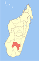 | |
| Ihosy (20) - 313 | ||
| Ivohibe (6) - 315 |
| |
3 districts; 31 communes | ||
This Ihorombe location article is a stub. You can help Wikipedia by . |
Categories:
- Madagascar geography stubs
- Districts of Ihorombe