Ivohibe
Ivohibe | |
|---|---|
District | |
 Ivohibe | |
 Location in Madagascar | |
| Coordinates: 22°21′S 45°49′E / 22.350°S 45.817°E | |
| Country | |
| Region | Ihorombe |
| Area | |
| • Total | 4,119 km2 (1,590 sq mi) |
| Population (2018)Census | |
| • Total | 22,290 |
| Time zone | UTC3 (EAT) |
| Postal code | 315 |

Ivohibe is a hilly town in Ihorombe Region in central Madagascar.
It is connected with Ihosy in the west, and Farafangana in the east by the largely unpaved Route nationale 27.
See also[]
Pic d'Ivohibe Reserve and the Andringitra National Park that are nearby.
Coordinates: 22°11′S 46°28′E / 22.18°S 46.46°E
Capital: Ihosy | ||
| Iakora (5) - 311 | 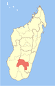 | |
| Ihosy (20) - 313 | ||
| Ivohibe (6) - 315 |
| |
3 districts; 31 communes | ||
This Ihorombe location article is a stub. You can help Wikipedia by . |
Categories:
- Populated places in Ihorombe
- Madagascar geography stubs