Jagdishpur, Sultanpur
Jagdishpur
Jagdīspur | |
|---|---|
Town | |
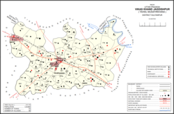 Map showing Jagdishpur CD block | |
 Jagdishpur Location in Uttar Pradesh, India | |
| Coordinates: 26°27′23″N 81°37′08″E / 26.456357°N 81.618961°ECoordinates: 26°27′23″N 81°37′08″E / 26.456357°N 81.618961°E[1] | |
| Country | |
| State | Uttar Pradesh |
| Division | Faizabad division |
| District | Sultanpur |
| Languages | |
| • Official | Hindi, Urdu |
| Time zone | UTC+5:30 (IST) |

Jagdishpur is a town,[2] community development block,[3] and former pargana in Musafirkhana tehsil of Sultanpur district, Uttar Pradesh, India.[3][2] It is also called , , or Nihalgarh-Jagdispur.[2] The distinction is that Jagdishpur was the original village, Chak Jangla was an outlying hamlet of Jagdishpur, and Nihalgarh was a fort built in Chak Jangla in the early 1700s and that no longer exists.[2] The town is located at the crossroads between the Lucknow-Jaunpur and Raebareli-Faizabad highways.[2]
Jagdishpur hosts a Dussehra festival involving reenactment of scenes from the Ramayana.[4] Vendors bring sweets, toys, cloth, bangles, utensils, and earthenware pottery to sell at the event.[4]
History[]
Jagdishpur was originally named after a Brahmin zamindar named Jagdis who lived at the time when the area was ruled by the Bhars.[2] In 1715, the Bhale Sultan leader Nihal Khan established a fort at the outlying hamlet of Chak Jangla.[2] He named the fort Nihalgarh after himself, and a town sprang up around it that came to eclipse Jagdishpur proper.[2] In 1750, the tehsildar Mirza Latif Beg besieged and captured Nihalgarh; he then made it his residence.[2] Up to that time, there had been two parganas in the area at and (or Satanpur), but either Nihal Khan or Mirza Latif Beg united the two parganas into one based at Jagdishpur.[2] Sometime after 1750 but before the 20th century, the fort of Nihalgarh was torn down.[2]
At the turn of the 20th century, the town of Jagdishpur/Nihalgarh had a police station, a middle vernacular school with about 150 students, and a registration office located at the Gulabganj sarai.[2] It also had a small bazar, which mostly dealt in everyday goods like food and clothing, as well as brass vessels made by the Thatheras.[2] There was only one masonry house, which had been built by a wealthy Agarwal Bania named Balmukand who had acquired a small estate by purchase and mortgage.[2] Balmukand's successor, Bibi Rampiari, owned seven villages and two in the area at the time.[2] As of 1901, the population of the town was 2,121 people, including 1,168 Muslims.[2]
The 1951 census recorded Jagdishpur as having a district board-run primary school, with 197 students in attendance as of 1 January of the year.[5]
The 1961 census recorded Jagdishpur as having a police force of 2 sub-inspectors, 1 head constable, and 14 constables.[4] It had a dispensary run by a local body with 12 male beds and 8 female beds, a maternity and child welfare centre, and a post office.[4] Average attendance of the Dussehra festival was about 1,500 people then.[4]
Villages[]
Jagdishpur CD block has the following 91 villages:[3]
| Village name | Total land area (hectares) | Population (in 2011) |
|---|---|---|
| 756.9 | 4,800 | |
| 358.8 | 2,338 | |
| 326.9 | 3,087 | |
| 108 | 725 | |
| 477.8 | 3,541 | |
| 499.3 | 3,841 | |
| 494 | 5,506 | |
| 396.3 | 4,453 | |
| 429.2 | 2,552 | |
| 209.9 | 2,760 | |
| 120.9 | 652 | |
| 70.6 | 701 | |
| 107.3 | 793 | |
| 97 | 1,783 | |
| 108 | 1,255 | |
| 274.7 | 3,943 | |
| 155.4 | 1,817 | |
| 358.9 | 3,169 | |
| 30.2 | 366 | |
| 199.5 | 1,058 | |
| 314.5 | 4,187 | |
| 269.8 | 4,602 | |
| 554.6 | 4,551 | |
| 117.8 | 865 | |
| 82.6 | 1,525 | |
| 70.8 | 854 | |
| 237.5 | 2,658 | |
| 86.1 | 1,224 | |
| 207.6 | 1,165 | |
| 421.4 | 2,686 | |
| 128.5 | 870 | |
| 530.2 | 4,989 | |
| 731.4 | 6,916 | |
| 503.3 | 4,346 | |
| 80.3 | 1,024 | |
| 224.8 | 2,680 | |
| 79.6 | 691 | |
| 66.7 | 1,643 | |
| 407.5 | 6,910 | |
| 390.1 | 4,412 | |
| 480.2 | 4,009 | |
| 46.8 | 722 | |
| 307.6 | 2,332 | |
| 373.9 | 4,386 | |
| 163.6 | 1,237 | |
| 558.9 | 5,851 | |
| 183.2 | 2,278 | |
| 126.5 | 1,039 | |
| 359.4 | 2,866 | |
| 27.5 | 1,175 | |
| 76.3 | 835 | |
| 353.9 | 2,341 | |
| 269.2 | 2,120 | |
| 258.1 | 2,292 | |
| 466.8 | 7,418 | |
| 23.7 | 296 | |
| 90.8 | 461 | |
| 83.7 | 874 | |
| 113.3 | 1,496 | |
| 128.6 | 1,585 | |
| 42.3 | 447 | |
| 835.8 | 2,846 | |
| 362.4 | 3,588 | |
| 135.1 | 1,047 | |
| 205.9 | 2,283 | |
| 41.6 | 288 | |
| 102.4 | 1,658 | |
| 236.3 | 1,216 | |
| 305.1 | 3,272 | |
| 119.9 | 1,094 | |
| 176.8 | 2,971 | |
| 108.6 | 701 | |
| 102.8 | 1,235 | |
| 89.7 | 779 | |
| 215.6 | 2,111 | |
| 381 | 2,938 | |
| 328.6 | 2,948 | |
| 55.7 | 473 | |
| 180.4 | 2,672 | |
| 148.4 | 761 | |
| 98 | 1,315 | |
| 165.4 | 1,721 | |
| 78.5 | 338 | |
| 204.4 | 2,105 | |
| 323.1 | 3,443 | |
| 246.7 | 4,001 | |
| 195.4 | 1,893 | |
| Gaimau | 255.6 | 1,617 |
References[]
- ^ "Geonames Search". Do a radial search using these coordinates here.
- ^ a b c d e f g h i j k l m n o p Nevill, H.R. (1903). Sultanpur: A Gazetteer, Being Volume XLVI Of The District Gazetteers Of The United Provinces Of Agra And Oudh. Allahabad: Government Press. pp. 183–6. Retrieved 13 November 2021.
- ^ a b c "Census of India 2011: Uttar Pradesh District Census Handbook - Sultanpur, Part A (Village and Town Directory)" (PDF). Census 2011 India. pp. 94–111. Retrieved 13 November 2021.
- ^ a b c d e Census 1961: District Census Handbook, Uttar Pradesh (44 - Sultanpur District) (PDF). Lucknow. 1965. pp. 118, 121–2, 126, 128, 142–3. Retrieved 13 November 2021.
- ^ Census of India, 1951: District Census Handbook Uttar Pradesh (49 - Rae Bareli District) (PDF). Allahabad. 1955. p. 199. Retrieved 13 November 2021.
This Sultanpur district location article is a stub. You can help Wikipedia by . |
- Cities and towns in Sultanpur district
- Community development blocks in India
- Faizabad division geography stubs