Javakheti Plateau
| Javakheti Plateau | |
|---|---|
 Javakheti Plateau. | |
 | |
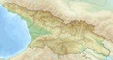
| Location | Samtskhe-Javakheti, |
| Coordinates | 41°30′00″N 43°30′00″E / 41.50000°N 43.50000°ECoordinates: 41°30′00″N 43°30′00″E / 41.50000°N 43.50000°E |
| Geology | volcanic plateau |

Javalkheti Plateau (Georgian: ჯავახეთის პლატო) is a volcanic plateau within the Caucasus Mountains that covers the Samtskhe-Javakheti region of Georgia, along the border with Turkey and Armenia. Its elevation is over 2,000 m.[citation needed][vague]
Geography[]
The plateau is a large grassland plain (alpine steppe) with many wetlands and alpine lakes (six of the largest lakes of Georgia, , Paravani, , Madatapa, Kartsakhi, Saghamo).
The Javalkheti Wetlands are included in the Ramsar List of Wetlands of International Importance.
The plain is crossed from north to south by the Abuli-Samsari Mountain Range, a series of volcanic cones. The western side of the plateau is surrounded by the Javakheti Range.[1]
See also[]
References[]
This Georgia location article is a stub. You can help Wikipedia by . |
- Lava plateaus
- Mountains of Georgia (country)
- Landforms of the Caucasus
- Volcanoes of Georgia (country)
- Georgia (country) geography stubs