Jind State
| Jind & Sangrur State | |||||||||
|---|---|---|---|---|---|---|---|---|---|
| Princely State of British India (1809–1948) | |||||||||
| 1763–20 August 1948 | |||||||||
 Coat of arms
| |||||||||
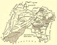 Jind State in a 1911 map of Punjab | |||||||||
| Capital | Sangrur | ||||||||
| Area | |||||||||
• 1931 | 3,460 km2 (1,340 sq mi) | ||||||||
| Population | |||||||||
• 1931 | 324,676 | ||||||||
| History | |||||||||
• Established | 1763 | ||||||||
• Accession to India | 20 August 1948 | ||||||||
| |||||||||
| Today part of | India | ||||||||
Jind State (also spelled Jhind State) was a princely state located in the Punjab region of north-western India. The state was 3,260 km2 (1,260 sq mi) in area and its annual income was Rs.3,000,000 in the 1940s.[citation needed]
History
The state of Jind & Sangrur was founded in 1763.[citation needed] It was part of the Cis-Sutlej states[citation needed] until 25 April 1809, when it became a British protectorate.[1]
On 20 August 1948, with the signing of the instrument of accession, Jind became a part of the Patiala and East Punjab States Union. Jind town and district now form a part of Indian state of Haryana.
Postage stamps prior to King George V consisted of Indian stamps over printed as "Jhind State", with the letter 'H' in the name. On the George V stamps, the 'H' is omitted and is overprinted as "Jind State" (Reference actual stamps from the Victorian, Edward VII and George V eras).
 Raja Sangat Singh |
 Maharaja Raghbir Singh, photographed in 1875, ruled Jind until his death in 1887 |
See also
References
- ^ Chisholm, Hugh, ed. (1911). . Encyclopædia Britannica. 15 (11th ed.). Cambridge University Press. p. 416.
External links
 Media related to Jind State at Wikimedia Commons

- States and territories established in 1763
- States and territories disestablished in 1948
- Princely states of India
- History of Haryana
- Jind district
- 1763 establishments in India
- 1948 disestablishments in India