Jinning, Kinmen
Coordinates: 24°27′24″N 118°20′04″E / 24.456720°N 118.334506°E

Jinning Township
金寧鄉 | |
|---|---|
 | |
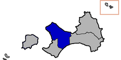 Jinning Township (blue) in Kinmen County (grey) | |
| Country | |
| County | |
| Rural villages | 6 |
| Government | |
| • Mayor | Yang Chung-Chun (楊忠俊) |
| Area | |
| • Total | 29.8540 km2 (11.5267 sq mi) |
| Population (July 2018) | |
| • Total | 30,870 |
| • Density | 1,000/km2 (2,700/sq mi) |
| Postal code | 892 |
| Website | jinning |

Jinning Township (Chinese: 金寧鄉; pinyin: Jīnníng Xiāng; Wade–Giles: Chin¹-ning² Hsiang¹; Pe̍h-ōe-jī: Kim-lêng-hiong) is a rural township in Kinmen, Republic of China. It is in the Taiwan Strait, on the coast of mainland China. It has a population of 27,307[when?] and an area of 29.8540 km2 (11.5267 sq mi).[5]
History[]
In 1913, Sen-you Li (李森佑) founded the Guning Advanced Elementary School (古寧高等小學).[6][7]
In October 1949, today's Jinning Township was the site of the Battle of Kuningtou.[6]
Jinning Township was established in 1953.[8]
In 1999, the Kinmen County Government established a horseshoe crab conservation area of about 800 hectares in the tidal flat[9] northwest of Guningtou (Ku-ning-t'ou,[9] 古寧頭[9]).[6][7]
Administrative divisions[]
Jinning is divided into six rural villages:[6][7][10][11]
- Anmei Village (安美村)
- Banglin Village (Pang-lin,[9][12] 榜林村)
- Guning Village (古寧村)
- Houpan Village (后盤村)
- Hupu Village (湖埔村)
- Panshan Village (盤山村)
Education[]
Tourist attractions[]
- Beishan Broadcasting Wall
- Beishan Old Western-style House
- Chiang Ching-kuo Memorial Hall
- Ci Lake
- Gulongtou Zhenwei Residence
- Guningtou Battle Museum
- Houhu Seashore Park
- Kinmen Peace Memorial Park
Transportation[]
In the future, Jinning will be connected to Lieyu / Lesser Kinmen by Kinmen Bridge which is currently still under construction.[13]
See also[]
References[]
- ^ DAVID CHAO, YU-PO HSU, PING-CHIN FAN (3 September 1985). "MEDICALLY IMPORTANT SNAILS OF KINMEN (QUEMOY) ISLANDS" (PDF). Southeast Asian Journal of Tropical Medicine and Public Health. 16 (3): 481. Retrieved 22 September 2019.
Kinning
CS1 maint: uses authors parameter (link) - ^ "Public Health Center". Public Health Bureau, Kinmen County. 5 November 2014. Retrieved 25 August 2019.
Chinning Township Public health center Address: No. 1, Renai New Village, Chinning Township, Kinmen County
- ^ Chin-ning (Variant - V) at GEOnet Names Server, United States National Geospatial-Intelligence Agency
- ^ 行政面積. 金門縣政府民政處 Civil Affairs Department, Kinmen County Government (in Chinese). 29 January 2019. Retrieved 23 August 2019.
行政區 面積(單位:平方公里){...}金寧鄉 29.8540
- ^ "PLA soldiers' relatives to remember loss on Kinmen". taipeitimes.com.
- ^ a b c d "Villages and Scenic Spots in Jinning Town". Jinning Township Administration, Kinmen County. 18 December 2008. Retrieved 23 August 2019.
Guning Village{...}Guningtou Cliff and Public Announcement Station ─ The cliff is located in the northwest coast of Guningtou with reddish-yellow soil. After the shocking battle that started in the beach and ended in Guningtou Cliff in 1949, Taiwan’s national forces built a PA station here in order to keep up the soldiers’ morale. The large speakers still stand today, and this beach is a good spot for fishing and swimming.{...}Anmei Village{...}Houpan Village{...}Hupu Village{...}Panshan Village{...}Banglin Village{...
} - ^ a b c 金寧鄉各村概述. 金寧鄉公所 (in Chinese). 7 August 2017. Retrieved 23 August 2019.
古寧村{...}安美村{...}后盤村{...}湖埔村{...}盤山村{...}榜林村
- ^ 歷史沿革 [Historical Development]. 金寧鄉公所 (in Chinese). 2 July 2019. Retrieved 24 August 2019.
四十二年恢復縣治,本鄉合併為古寧、安美、湖埔、榜林、盤山、后盤等六個行政區,才定名為金寧鄉公所,設址於頂堡,
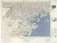
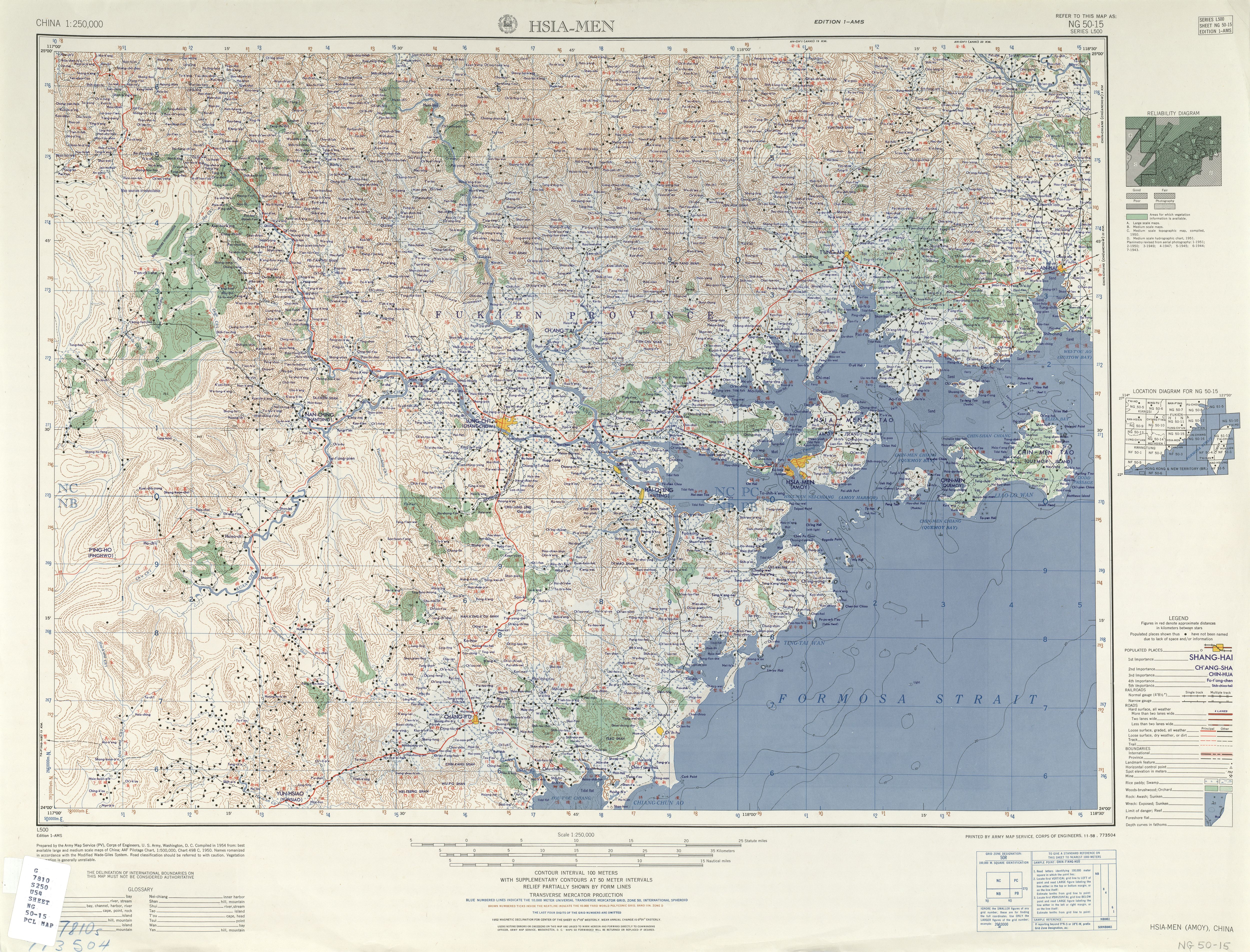
- ^ a b c d "NG 50-15 HSIA-MEN". Washington, D. C.: Army Map Service. 1954 – via Perry–Castañeda Library Map Collection.
Probable tidal flats Ku-ning-t'ou 古寧頭 Pang-lin
- ^ "2018 Local Elections". Central Election Commission. Retrieved 23 August 2019.
Guning Vil. Anmei Vil. Houpan Vil. Hupu Vil. Banglin Vil. Panshan Vil.
- ^ 107年地方公職人員選舉 (in Chinese). Central Election Commission. Retrieved 23 August 2019.
古寧村 安美村 后盤村 湖埔村 榜林村 盤山村
- ^ Pang-lin (Variant - V) at GEOnet Names Server, United States National Geospatial-Intelligence Agency
- ^ "President Ma: Construction of Kinmen Bridge Signifies Kinmenese Hope" 馬總統:大橋興建代表金門人民希望 (in Chinese and English). Translated by Wilson Chou. Kinmen Daily News. 24 January 2011. Retrieved 24 August 2019.
President Ma explained the reason for building a bridge linking Kinmen and Lieyu (Little Kinmen) as follows: With the resident population of Lieyu Township being only between 2000-3000, transportation is not the primary reason. With what the central government most concerned is Kinmen's status in the overall cross-strait relation and its competition with Xiamen. He believed that with the completion of the construction, Kinmen Bridge will become a marvelous tourist landmark in Kinmem [sic]. 馬總統說,烈嶼鄉的常住人口不過兩、三千人,蓋橋除了考量大、小金門的交通,最主要是看重金門在整個兩岸關係的地位,以及未來面對廈門的競爭。他相信,金門大橋的興建,將成為金門觀光的絕佳地標。
| Wikimedia Commons has media related to Jinning Township, Kinmen County. |

- Townships in Kinmen County