Johan Pienaar Airport
Johan Pienaar Airport | |||||||||||
|---|---|---|---|---|---|---|---|---|---|---|---|
| Summary | |||||||||||
| Airport type | Public | ||||||||||
| Serves | Kuruman, South Africa | ||||||||||
| Elevation AMSL | 4,382 ft / 1,336 m | ||||||||||
| Coordinates | 27°27′24″S 023°24′41″E / 27.45667°S 23.41139°ECoordinates: 27°27′24″S 023°24′41″E / 27.45667°S 23.41139°E | ||||||||||
| Map | |||||||||||
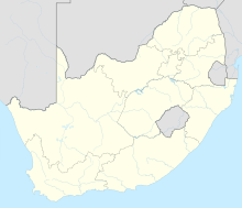
 KMH Location in the Northern Cape | |||||||||||
| Runways | |||||||||||
| |||||||||||

Johan Pienaar Airport (IATA: KMH, ICAO: FAKU) is an airport serving Kuruman, a town in Northern Cape province, South Africa.[1][2]
References[]
- ^ Jump up to: a b Airport information for FAKU at World Aero Data. Data current as of October 2006.Source: DAFIF.
- ^ Jump up to: a b Airport information for KMH at Great Circle Mapper. Source: DAFIF (effective October 2006).
External links[]
This article about an airport in South Africa is a stub. You can help Wikipedia by . |
Categories:
- Airports in South Africa
- Transport in the Northern Cape
- Ga-Segonyana Local Municipality
- Southern African airport stubs
- South Africa transport stubs
- South African building and structure stubs