Johnson City, Oregon
Johnson City, Oregon | |
|---|---|
 Lake Leona in Johnson City, Oregon | |
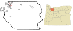 Location in Oregon | |
| Coordinates: 45°24′17″N 122°34′51″W / 45.40472°N 122.58083°WCoordinates: 45°24′17″N 122°34′51″W / 45.40472°N 122.58083°W | |
| Country | United States |
| State | Oregon |
| County | Clackamas |
| Incorporated | 1970 |
| Government | |
| • Mayor | Vince Whitehead |
| Area | |
| • Total | 0.07 sq mi (0.18 km2) |
| • Land | 0.07 sq mi (0.17 km2) |
| • Water | 0.00 sq mi (0.01 km2) |
| Elevation | 60 ft (20 m) |
| Population | |
| • Total | 566 |
| • Estimate (2019)[4] | 629 |
| • Density | 9,676.92/sq mi (3,739.73/km2) |
| Time zone | UTC-8 (Pacific) |
| • Summer (DST) | UTC-7 (Pacific) |
| ZIP code | 97267 |
| Area code(s) | 503 and 971 |
| FIPS code | 41-37650[2] |
| GNIS feature ID | 1639428[3] |

Johnson City is a city in Clackamas County, Oregon, United States. The population was 566 at the 2010 census. Because of its small area, its population density is over 8,000 per square mile, making it the most densely populated city in Oregon.[5]
History[]
On June 16, 1970, the residents of a trailer court owned by Delbert Johnson voted 49-to-10 to incorporate. Johnson had started the development in 1959, and in 1968 was unsuccessful in having the area annexed to Gladstone. The in 1969 established a boundary review board to prevent an increase in small incorporated cities, but proponents of Johnson City's incorporation had filed for an election before the law took effect.[6] Due to a vote against a library measure, Johnson City residents are not able to obtain free library cards for county libraries in Clackamas County.
Geography[]
According to the United States Census Bureau, the city has a total area of 0.07 square miles (0.18 km2), all of it land.[7]
Demographics[]
| Historical population | |||
|---|---|---|---|
| Census | Pop. | %± | |
| 1980 | 378 | — | |
| 1990 | 586 | 55.0% | |
| 2000 | 634 | 8.2% | |
| 2010 | 566 | −10.7% | |
| 2019 (est.) | 629 | [4] | 11.1% |
| U.S. Decennial Census[8] | |||
2010 census[]
As of the census of 2010, there were 566 people, 268 households, and 141 families living in the city. The population density was 8,085.7 inhabitants per square mile (3,121.9/km2). There were 278 housing units at an average density of 3,971.4 per square mile (1,533.4/km2). The racial makeup of the city was 84.3% White, 0.4% African American, 1.4% Native American, 1.9% Asian, 7.4% from other races, and 4.6% from two or more races. Hispanic or Latino of any race were 15.4% of the population.[2]
There were 268 households, of which 19.8% had children under the age of 18 living with them, 36.9% were married couples living together, 13.1% had a female householder with no husband present, 2.6% had a male householder with no wife present, and 47.4% were non-families. 40.3% of all households were made up of individuals, and 14.9% had someone living alone who was 65 years of age or older. The average household size was 2.09 and the average family size was 2.84.[2]
The median age in the city was 47.1 years. 18.7% of residents were under the age of 18; 6.2% were between the ages of 18 and 24; 22.8% were from 25 to 44; 33.8% were from 45 to 64; and 18.6% were 65 years of age or older. The gender makeup of the city was 48.8% male and 51.2% female.[2]
2000 census[]
As of the census of 2000, there were 634 people, 275 households, and 169 families living in the city. The population density was 11,061.5 people per square mile (4,079.8/km2). There were 286 housing units at an average density of 4,989.9 per square mile (1,840.4/km2). The racial makeup of the city was 93.69% White, 1.10% African American, 1.10% Native American, 0.47% Asian, 1.58% from other races, and 2.05% from two or more races. Hispanic or Latino of any race were 3.79% of the population.[2]
There were 275 households, out of which 24.4% had children under the age of 18 living with them, 44.4% were married couples living together, 13.1% had a female householder with no husband present, and 38.2% were non-families. 32.4% of all households were made up of individuals, and 12.0% had someone living alone who was 65 years of age or older. The average household size was 2.28 and the average family size was 2.84.[2]
In the city, the population was spread out, with 22.2% under the age of 18, 6.2% from 18 to 24, 30.0% from 25 to 44, 26.5% from 45 to 64, and 15.1% who were 65 years of age or older. The median age was 39 years. For every 100 females, there were 98.7 males. For every 100 females age 18 and over, there were 93.3 males.[2]
The median income for a household in the city was $35,517, and the median income for a family was $36,985. Males had a median income of $32,500 versus $23,523 for females. The per capita income for the city was $16,967. About 6.1% of families and 8.1% of the population were below the poverty line, including 9.9% of those under age 18 and 10.7% of those age 65 or over.[2]
Management[]
Johnson City is also known as Johnson Mobile Estates, a mobile home park. It has a high turnover rate, and houses are often replaced instead of resold. Rent is increased every year, with the most recent increases at $30 a month. Lease agreements are 15 pages long, and include such rules as visitors can stay no more than 4 hours and only 6 yard decorations are now allowed and must be approved by management. Management patrols the area multiple times a day, recording and handing out violations.
See also[]
 Oregon portal
 Pacific Northwest portal
References[]
- ^ "2019 U.S. Gazetteer Files". United States Census Bureau. Retrieved July 28, 2020.
- ^ Jump up to: a b c d e f g h i "U.S. Census website". United States Census Bureau. Retrieved 2012-12-21.
- ^ "US Board on Geographic Names". United States Geological Survey. 2007-10-25. Retrieved 2008-01-31.
- ^ Jump up to: a b "Population and Housing Unit Estimates". United States Census Bureau. May 24, 2020. Retrieved May 27, 2020.
- ^ Bureau, US Census. "Decennial Census by Decades". www.census.gov. Retrieved 2019-08-13.
- ^ McArthur, Lewis A.; McArthur, Lewis L. (2003) [1928]. Oregon Geographic Names (7th ed.). Portland, Oregon: Oregon Historical Society Press. p. 515. ISBN 978-0875952772.
- ^ "US Gazetteer files 2010". United States Census Bureau. Archived from the original on 2012-01-24. Retrieved 2012-12-21.
- ^ "Census of Population and Housing". Census.gov. Retrieved June 4, 2015.
Further reading[]
- "Trailer Court Votes 49–10 to become 'Johnson City'". The Oregonian. June 17, 1970.
External links[]
| show Municipalities and communities of Clackamas County, Oregon, United States |
|---|

| show Authority control |
|---|
- 1959 establishments in Oregon
- Cities in Clackamas County, Oregon
- Cities in Oregon
- Portland metropolitan area