West Linn, Oregon
West Linn | |
|---|---|
City | |
| West Linn, Oregon | |
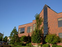 West Linn City Hall | |
 Flag  Seal | |
| Motto(s): City of Hills, Trees and Rivers | |
 Location in Oregon | |
| Coordinates: 45°21′55″N 122°38′28″W / 45.36528°N 122.64111°WCoordinates: 45°21′55″N 122°38′28″W / 45.36528°N 122.64111°W | |
| Country | United States |
| State | Oregon |
| County | Clackamas |
| Incorporated | 1913 |
| Named for | Lewis F. Linn |
| Government | |
| • Mayor | Jules Walters (D) |
| Area | |
| • Total | 8.09 sq mi (20.95 km2) |
| • Land | 7.42 sq mi (19.22 km2) |
| • Water | 0.67 sq mi (1.73 km2) |
| Elevation | 105 ft (32 m) |
| Population | |
| • Total | 25,109 |
| • Estimate (2019)[3] | 26,736 |
| • Density | 3,603.23/sq mi (1,391.29/km2) |
| Time zone | UTC-8 (Pacific) |
| • Summer (DST) | UTC-7 (Pacific) |
| ZIP code | 97068 |
| Area code(s) | 503 |
| FIPS code | 41-80150[4] |
| GNIS feature ID | 1128884[5] |
| Website | westlinnoregon.gov |

West Linn is a city in Clackamas County, Oregon, United States. An affluent southern suburb within the Portland metropolitan area, West Linn has a history of early development, prompted by the opportunity to harvest energy from nearby Willamette Falls. It was named after U.S. Senator Lewis F. Linn of Ste. Genevieve, Missouri, who had advocated the American occupation of Oregon as a counterclaim to the British. As of the 2010 census, the city had a population of 25,109.
History[]
This section needs additional citations for verification. (November 2007) |
Prior to settlement by Oregon pioneers, the area which became known as West Linn was the home of ancestors of some of the present-day Confederated Tribes of the Grand Ronde Community of Oregon.
19th century[]
Major Robert Moore was an early settler arriving in 1839—before the Champoeg Meetings—having been the senior member of the first attempt to create an American state in Oregon, the Peoria Party.[6] Sometime after journeying around the Willamette Valley and Columbia Basin, Moore bought title to approx. 1,000 acres (400 ha) on the west side of Willamette Falls, across the Willamette River from Oregon City, from a local Native American chief,[vague] on which he platted a town he called "Robin's Nest" in early 1843.[citation needed] He also filed a provisional claim with the then government of the Oregon Country, not knowing if his transaction would be honored by the eventual governing laws. The Oregon Territorial Legislature voted to rename it Linn City on December 22, 1845 as a memorial to Senator Lewis F. Linn after whom Linn County is also named. Linn was a neighbor and family friend of the Moores from their time as settlers in the early Missouri Territory.[citation needed]
For many years Linn City was a political and commercial rival to the adjacent town of Oregon City,[citation needed] but it suffered a series of natural and man-made setbacks. A major fire and the Great Flood of 1862 put a halt to the pioneer settlement in 1861, dispersing many of the surviving family members throughout the Pacific Northwest.
20th century[]
This section needs expansion. You can help by . (April 2012) |
West Linn was incorporated in 1913 and merged with the adjacent town of Willamette in 1916, which had incorporated five years earlier.[7] When the City of West Linn incorporated in 1913, it encompassed West Oregon City, Bolton, Sunset and Willamette Heights. The incorporation allowed the settlements to obtain needed services, utilities, and improvements without annexing to Oregon City. After considerable debate on a name, the city founders decided to honor the pioneer town that Moore had established. The city's population historically grew steadily, but in recent years has leveled off. The 1860 census listed 225 residents. By 1920, the number had grown to 1,628. The 1960 census set the population at 2,923, and by 1970, West Linn had grown to more than 7,000. The city's population has continued to grow each year. Currently, the city's population is 25,250.
21st century[]
In 2011, the City of West Linn was the Top-Ranked Oregon City on the CNN/Money Magazine 'Best Places to Live 2011' List. Citing 'breathtaking views of the Cascades and relatively low local taxes,' the Number 69 listing includes a photo of Central Village, and also mentions the Music in the Park concert series, the historic Willamette area, the farmer's market, and the Street Dance. The City of Sherwood is the only other Oregon city to make the 2011 listing, coming in at Number 100. In 2009, the City of West Linn was included on the 'Best Places to Live 2009' list. Oregonians move to the hilltop homes here for a scenic view of the Cascades and relatively low local taxes. With Portland just 25 minutes away, most residents commute into the city during the week. Weekends are spent enjoying waterfront recreation: West Linn sits at the junction of two rivers. On summer evenings, residents enjoy picnic dinners over concerts in the park. Locals also flock to a revitalized downtown area, Historic Willamette, which offers a farmer's market and, occasionally, dancing in the street.
In 2012, the City of West Linn was named Tree City USA Community by the Arbor Day Foundation for its commitment to urban forestry. It is the 19th year West Linn has earned this national honor from the Arbor Day Foundation, the nation's largest nonprofit organization dedicated to planting trees. "We all benefit when communities like West Linn place a high priority on planting and caring for trees, one of our nation's most beautiful resources," said John Rosenow, chief executive and founder of the Arbor Day Foundation. "Trees shade our homes and add beauty to our neighborhoods, and they also provide many environmental, economic and social benefits. We applaud West Linn's elected officials, volunteers and citizens for providing vital care for its urban forest."
Geography[]
According to the United States Census Bureau, the city has a total area of 8.05 square miles (20.85 km2), of which, 7.39 square miles (19.14 km2) is land and 0.66 square miles (1.71 km2) is water.[8] The city is located between the Willamette and Tualatin rivers; it includes the former townsites/developments of Willamette, Bolton, Multnomah City, Sunset City, and West Oregon City. Willamette was incorporated in 1908, the City of West Linn was incorporated in 1913, and the two towns merged in 1916. Later annexations brought in the Cedaroak, Marylhurst and Hidden Springs neighborhoods. Infill created the Tanner Basin and Tannler neighborhoods.[citation needed]
The Nature Conservancy maintains the Camassia Natural Area in central West Linn as one of its conservancy preserves.[9] The 26-acre (11 ha)-area is located on a rocky plateau exposed by the Bretz Floods and now named after the camas which bloom there in spring; it hosts about 300 other species, including the white rock larkspur, a species located in only a half dozen other places in the world.[10] It supports Oregon white oak-madrone woodlands, a stand of quaking aspen, wet meadows, ponds, and vernal pools.[10]
The Mary S. Young State Recreation Area, located between Oregon Route 43 and the Willamette River, featuring a large off leash dog area, soccer fields and 5–8 miles worth of trails is located in West Linn.
West Linn is located in the area where the Willamette Meteorite was placed by the Missoula Floods.
Climate[]
Extremes range from −2 °F (−19 °C), recorded in 1950, to 107 °F (42 °C), recorded in 1956 and 1981.[11]
| hideClimate data for West Linn, OR | |||||||||||||
|---|---|---|---|---|---|---|---|---|---|---|---|---|---|
| Month | Jan | Feb | Mar | Apr | May | Jun | Jul | Aug | Sep | Oct | Nov | Dec | Year |
| Record high °F (°C) | 66 (19) |
75 (24) |
81 (27) |
92 (33) |
104 (40) |
103 (39) |
107 (42) |
107 (42) |
105 (41) |
96 (36) |
73 (23) |
68 (20) |
107 (42) |
| Average high °F (°C) | 49 (9) |
53 (12) |
58 (14) |
64 (18) |
70 (21) |
76 (24) |
83 (28) |
84 (29) |
78 (26) |
65 (18) |
53 (12) |
47 (8) |
65 (18) |
| Average low °F (°C) | 37 (3) |
37 (3) |
40 (4) |
43 (6) |
48 (9) |
53 (12) |
56 (13) |
56 (13) |
52 (11) |
46 (8) |
40 (4) |
35 (2) |
45 (7) |
| Record low °F (°C) | −2 (−19) |
6 (−14) |
22 (−6) |
28 (−2) |
31 (−1) |
37 (3) |
41 (5) |
41 (5) |
33 (1) |
24 (−4) |
9 (−13) |
6 (−14) |
−2 (−19) |
| Average precipitation inches (mm) | 6.78 (172) |
4.78 (121) |
4.67 (119) |
3.47 (88) |
2.46 (62) |
1.74 (44) |
0.65 (17) |
0.72 (18) |
1.61 (41) |
3.61 (92) |
6.56 (167) |
7.32 (186) |
44.37 (1,127) |
| Source: [12] | |||||||||||||
Demographics[]


| Historical population | |||
|---|---|---|---|
| Census | Pop. | %± | |
| 1920 | 1,628 | — | |
| 1930 | 1,956 | 20.1% | |
| 1940 | 2,165 | 10.7% | |
| 1950 | 2,945 | 36.0% | |
| 1960 | 3,933 | 33.5% | |
| 1970 | 7,091 | 80.3% | |
| 1980 | 11,358 | 60.2% | |
| 1990 | 16,367 | 44.1% | |
| 2000 | 22,261 | 36.0% | |
| 2010 | 25,109 | 12.8% | |
| 2019 (est.) | 26,736 | [3] | 6.5% |
| Sources:[13][4][14][15][16] | |||
The median income for a household in the city was $72,010, and the median income for a family was $83,252 (These figures had risen to $94,844 and $108,821 respectively as of a 2007 estimate). Males had a median income of $61,458 versus $38,733 for females. The per capita income for the city was $34,671, among the state's top five. About 2.9% of families and 3.9% of the population were below the poverty line, including 3.6% of those under age 18 and 4.2% of those age 65 or over.
2010 census[]
As of the census[2] of 2010, there were 25,109 people, 9,523 households, and 7,081 families residing in the city. The population density was 3,397.7 inhabitants per square mile (1,311.9/km2). There were 10,035 housing units at an average density of 1,357.9 per square mile (524.3/km2). The racial makeup of the city was 90.7% White, 0.7% African American, 0.3% Native American, 4.0% Asian, 0.1% Pacific Islander, 1.0% from other races, and 3.1% from two or more races. Hispanic or Latino of any race were 4.0% of the population.
There were 9,523 households, of which 37.8% had children under the age of 18 living with them, 61.8% were married couples living together, 9.0% had a female householder with no husband present, 3.6% had a male householder with no wife present, and 25.6% were non-families. 20.6% of all households were made up of individuals, and 6.3% had someone living alone who was 65 years of age or older. The average household size was 2.62 and the average family size was 3.04.
The median age in the city was 41.5 years. 26.3% of residents were under the age of 18; 5.9% were between the ages of 18 and 24; 23.3% were from 25 to 44; 33.4% were from 45 to 64; and 11.1% were 65 years of age or older. The gender makeup of the city was 48.7% male and 51.3% female.
Education[]
Public schools in West Linn, including West Linn High School, are part of the West Linn-Wilsonville School District. It is also home to Columbia Academy, a private school licensed by Applied Scholastics.[17]
The city operates a public library that is part of the Library Information Network of Clackamas County.
Media[]
Notable people[]
- Steve Blake, former professional basketball player[18]
- Gert Boyle, the chairwoman of Columbia Sportswear, resident beginning in 1987[19]
- Jennifer and Sarah Hart, perpetrators of the Hart family murders[20]
- Darlene Hooley, United States Congresswoman
- Nate McMillan, former head coach of the Portland Trail Blazers[21]
- Cade McNown, football player
- Cole Gillespie, baseball player
- Michael Harper, former basketball player for the Portland Trail Blazers
- Robert Moore, founder of Linn City
- Brandon Roy, former basketball player for the Portland Trail Blazers
- Chael Sonnen, mixed martial artist
- Mitch Williams, baseball player[22]
- Monty Williams, former NBA player, former assistant coach of the Portland Trail Blazers, head coach of the Phoenix Suns[23]
- Payton Pritchard, basketball player
See also[]
- Tualatin Valley Fire and Rescue
 Oregon portal
 Pacific Northwest portal
References[]
- ^ "2019 U.S. Gazetteer Files". United States Census Bureau. Retrieved July 28, 2020.
- ^ Jump up to: a b "U.S. Census website". United States Census Bureau. Retrieved December 21, 2012.
- ^ Jump up to: a b "Population and Housing Unit Estimates". United States Census Bureau. May 24, 2020. Retrieved May 27, 2020.
- ^ Jump up to: a b "U.S. Census website". United States Census Bureau. Retrieved January 31, 2008.
- ^ "US Board on Geographic Names". United States Geological Survey. October 25, 2007. Retrieved January 31, 2008.
- ^ Tobie, Harvey Elmer (1949). No Man Like Joe: The Life and Times of Joseph L. Meek. Oregon Historical Society. Binford & Mort.
- ^ "Photographing History". West Linn Tidings. Pamplin Media Group. June 26, 2008. Retrieved April 20, 2013.
- ^ "US Gazetteer files 2010". United States Census Bureau. Retrieved December 21, 2012.
- ^ "Camassia Natural Area". Nature.org. February 8, 2011. Retrieved June 3, 2011.
- ^ Jump up to: a b "Oregon: Camassia Natural Area". The Nature Conservancy. Retrieved June 3, 2011.
- ^ "Monthly Averages for West Linn, OR (97068)". The Weather Channel. Retrieved March 18, 2012.
- ^ "Monthly Averages for West Linn, OR (97068)". Weather.com. Retrieved March 18, 2012.
- ^ "Population Estimates". United States Census Bureau. Retrieved October 3, 2014.
- ^ "Population-Oregon" (PDF). 15th Census of the United States. U.S. Census Bureau. Retrieved November 27, 2013.
- ^ "Number of Inhabitants: Oregon" (PDF). 18th Census of the United States. U.S. Census Bureau. Retrieved November 22, 2013.
- ^ "Pennsylvania: Population and Housing Unit Counts" (PDF). U.S. Census Bureau. Retrieved November 22, 2013.
- ^ "Philosophy & Approach". Columbia Academy. Retrieved April 13, 2012.
- ^ Peterson, Anne M. (July 13, 2007). "Guard Steve Blake Returning to Blazers". Washington Post. Retrieved December 21, 2009.
- ^ "Gert Boyle details violent attack against her". KATU. March 25, 2011. Retrieved April 13, 2012.
In her statement Boyle says she hasn't returned to her West Linn home of nearly 24 years since that night except to get her belongings.
- ^ Bush, Evan; Shapiro, Nina (April 8, 2018). "Who were the Harts, really? Mystery surrounds family that plunged off California cliff". The Seattle Times.
- ^ Quick, Jason (December 10, 2009). "McMillan struggles as injury puts him out of sight, even if he's not out of mind for Blazers". The Oregonian. Retrieved December 21, 2009.
- ^ "West Linn High inducts first Hall of Fame". West Linn Tidings. Pamplin Media Group. July 8, 2006. Retrieved April 20, 2013.
- ^ Freeman, Joe (November 3, 2008). "Faith, film and family". The Oregonian. Retrieved April 23, 2010.
and his West Linn home is theirs to visit should they want
External links[]
| Wikimedia Commons has media related to West Linn, Oregon. |
- City of West Linn (official website)
- West Linn listing in the Oregon Blue Book
- West Linn Chamber of Commerce
- West Linn Arts Commission
| show Municipalities and communities of Clackamas County, Oregon, United States |
|---|


| show Authority control |
|---|
- West Linn, Oregon
- Cities in Oregon
- Cities in Clackamas County, Oregon
- Populated places established in 1913
- Portland metropolitan area
- 1913 establishments in Oregon
- Populated places on the Willamette River