Jokioinen
Jokioinen
Jockis | |
|---|---|
Municipality | |
| Jokioisten kunta Jockis kommun | |
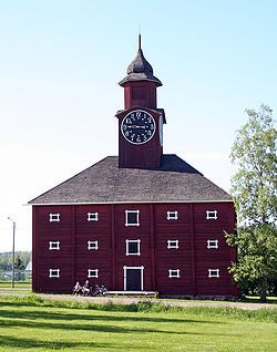 The bell towered grain storehouse of Jokioinen Estates in summer 2006 | |
 Coat of arms | |
 Location of Jokioinen in Finland | |
| Coordinates: 60°48′N 023°29′E / 60.800°N 23.483°ECoordinates: 60°48′N 023°29′E / 60.800°N 23.483°E | |
| Country | |
| Region | Tavastia Proper |
| Sub-region | Forssa sub-region |
| Charter | 1873 |
| Government | |
| • Municipal manager | Jarmo Määttä |
| Area (2018-01-01)[1] | |
| • Total | 181.94 km2 (70.25 sq mi) |
| • Land | 180.43 km2 (69.66 sq mi) |
| • Water | 1.52 km2 (0.59 sq mi) |
| Area rank | 270th largest in Finland |
| Population (2021-03-31)[2] | |
| • Total | 5,057 |
| • Rank | 169th largest in Finland |
| • Density | 28.03/km2 (72.6/sq mi) |
| Population by native language | |
| • Finnish | 98.3% (official) |
| • Swedish | 0.3% |
| • Others | 1.4% |
| Population by age | |
| • 0 to 14 | 14.7% |
| • 15 to 64 | 58.2% |
| • 65 or older | 27.1% |
| Time zone | UTC+02:00 (EET) |
| • Summer (DST) | UTC+03:00 (EEST) |
| Municipal tax rate[5] | 21.25% |
| Climate | Dfc |
| Website | www.jokioinen.fi |

Jokioinen (Swedish: Jockis) is a municipality of Finland.
It is located in the Tavastia Proper region. The municipality has a population of 5,057 (31 March 2021)[2] and covers an area of 181.94 square kilometres (70.25 sq mi) of which 1.52 km2 (0.59 sq mi) is water.[1] The population density is 28.03 inhabitants per square kilometre (72.6/sq mi). The municipality is unilingually Finnish.
The history of Jokioinen is tightly connected to the Jokioinen estate, which was established in 1562. The estate developed into the largest estate in Finland during the time of the provincial governor von Willebrand. At the beginning of 20th century the estate had a corn mill, saw mill, a brick factory, steel plant and a sugar and syrup factory.
Due to the crofters law of 1918 and the land reform law of 1945 the estate was split into more than 1500 homes and small farms. The rest of the estate was transferred to the ownership of the Finnish state in 1918. In 1928 the Department of Finnish Plant Breeding from Tikkurila and in 1957 the observatory from Pasila were transferred to the Jokioinen estate.
A notable tourist attraction in the region is the Jokioinen Museum Railway.
Climate[]
Jokioinen has a humid continental climate of the warm-summer type (Köppen: Dfb),[6] typical of the South Finnish fringe.[7] In the past it falls to the continental subarctic zone (Dfc, based in old data) with only 3 months above 10 °C.[8][9] The conditions are similar to Tampere, although it is more than 70 km to the north which shows influence of the urbanization in the climate.[10]
| hideClimate data for Jokioinen (Hakala), elevation: 103 m or 338 ft, 1961-1990 normals and extremes | |||||||||||||
|---|---|---|---|---|---|---|---|---|---|---|---|---|---|
| Month | Jan | Feb | Mar | Apr | May | Jun | Jul | Aug | Sep | Oct | Nov | Dec | Year |
| Record high °C (°F) | 7.4 (45.3) |
9.4 (48.9) |
14.0 (57.2) |
21.2 (70.2) |
27.7 (81.9) |
31.5 (88.7) |
29.9 (85.8) |
30.4 (86.7) |
27.6 (81.7) |
18.4 (65.1) |
11.3 (52.3) |
7.2 (45.0) |
31.5 (88.7) |
| Average high °C (°F) | −4.6 (23.7) |
−4.1 (24.6) |
0.4 (32.7) |
6.8 (44.2) |
15.0 (59.0) |
19.7 (67.5) |
20.9 (69.6) |
19.1 (66.4) |
13.4 (56.1) |
7.7 (45.9) |
1.7 (35.1) |
−2.2 (28.0) |
7.8 (46.1) |
| Daily mean °C (°F) | −7.5 (18.5) |
−7.4 (18.7) |
−3.5 (25.7) |
2.4 (36.3) |
9.4 (48.9) |
14.3 (57.7) |
15.8 (60.4) |
14.2 (57.6) |
9.4 (48.9) |
4.7 (40.5) |
−0.4 (31.3) |
−4.9 (23.2) |
3.9 (39.0) |
| Average low °C (°F) | −11.2 (11.8) |
−11.2 (11.8) |
−7.7 (18.1) |
−1.8 (28.8) |
3.2 (37.8) |
7.9 (46.2) |
10.3 (50.5) |
9.4 (48.9) |
5.6 (42.1) |
1.8 (35.2) |
−3.0 (26.6) |
−8.1 (17.4) |
−0.4 (31.3) |
| Record low °C (°F) | −36.7 (−34.1) |
−39.3 (−38.7) |
−29.0 (−20.2) |
−20.9 (−5.6) |
−7.0 (19.4) |
−3.1 (26.4) |
0.8 (33.4) |
−1.5 (29.3) |
−8.8 (16.2) |
−13.4 (7.9) |
−24.5 (−12.1) |
−33.4 (−28.1) |
−39.3 (−38.7) |
| Average precipitation mm (inches) | 36.0 (1.42) |
24.0 (0.94) |
25.0 (0.98) |
32.0 (1.26) |
35.0 (1.38) |
47.0 (1.85) |
80.0 (3.15) |
83.0 (3.27) |
65.0 (2.56) |
58.0 (2.28) |
55.0 (2.17) |
42.0 (1.65) |
582 (22.91) |
| Average precipitation days (≥ 1.0 mm) | 9.0 | 7.0 | 8.0 | 7.0 | 7.0 | 8.0 | 10.0 | 11.0 | 10.0 | 11.0 | 11.0 | 10.0 | 109 |
| Mean monthly sunshine hours | 36.6 | 70.5 | 133.0 | 174.4 | 252.1 | 276.4 | 247.2 | 203.6 | 125.0 | 81.2 | 35.4 | 27.3 | 1,662.7 |
| Source: NOAA[9] | |||||||||||||
Economy[]
Employment structure of Jokioinen by trade at the end of 2004 was following: Services 64.9%, processing 23.3%, agriculture and forestry economics 9.6%.
Major employers[]
- MTT Agrifood Research Finland: 480
- Jokioinen municipality: 305
- Boreal Plant Breeding Ltd: 68
- Jokioisten Leipä Oy (bakery): 45
- Suomen Sokeri Oy Finnsugar (sugar mill): 44
Employment structure by trade at the end of 2004 was following: Agriculture and forestry economics 16.3%, industry 22.0%, services 58.5%, unknown 3.2%.
Villages[]
Haapaniemi, Jokioinen, Jänhijoki, Kiipu, Lammi, Latovainio, Minkiö, Minkiön asema (Minkiö railway station), Niemi, Ojainen, Pellilä, Saari, and Vaulammi
Notable people[]
- Anneli Saaristo, (born 1949), singer
References[]
- ^ Jump up to: a b "Area of Finnish Municipalities 1.1.2018" (PDF). National Land Survey of Finland. Retrieved 30 January 2018.
- ^ Jump up to: a b "Preliminary population structure by area, 2021M01*-2021M03*". StatFin (in Finnish). Statistics Finland. Retrieved 2 May 2021.
- ^ "Population according to language and the number of foreigners and land area km2 by area as of 31 December 2008". Statistics Finland's PX-Web databases. Statistics Finland. Retrieved 29 March 2009.
- ^ "Population according to age (1-year) and sex by area and the regional division of each statistical reference year, 2003-2020". StatFin. Statistics Finland. Retrieved 2 May 2021.
- ^ "List of municipal and parish tax rates in 2021" (PDF). Tax Administration of Finland. 1 December 2020. Retrieved 10 April 2021.
- ^ "Jokioinen, Finland Köppen Climate Classification (Weatherbase)". Weatherbase. Retrieved 2019-03-04.
- ^ Peterson, Adam (2016-09-19), English: Köppen climate types of Finland, retrieved 2019-03-04
- ^ "Jokioinen Climate Jokioinen Temperatures Jokioinen Weather Averages". www.jokioinen.climatemps.com. Retrieved 2019-03-04.
- ^ Jump up to: a b "City (ID Station) - WMO Weather Station". NOAA. Retrieved March 4, 2019. Archived March 4, 2019, at the Wayback Machine
- ^ "FMI normals 1981-2010" (PDF). FMI. Retrieved 26 April 2016.
External links[]
 Media related to Jokioinen at Wikimedia Commons
 Jokioinen travel guide from Wikivoyage
- Municipality of Jokioinen – Official website

| show Authority control |
|---|
This Southern Finland location article is a stub. You can help Wikipedia by . |
- Jokioinen
- Municipalities of Kanta-Häme
- Populated places established in 1873
- Southern Finland Province geography stubs