Jwalamukhi Rural Municipality
This article needs additional citations for verification. (June 2017) |
Jwalamukhi
ज्वालामुखी | |
|---|---|
| Rural Municipality in Nepal | |
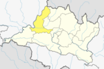
 Jwalamukhi Location in Nepal | |
| Coordinates: 27°38′43.3″N 84°34′3.68″E / 27.645361°N 84.5676889°ECoordinates: 27°38′43.3″N 84°34′3.68″E / 27.645361°N 84.5676889°E | |
| Country | Nepal |
| Development Region | Central |
| District | Dhading |
| Province | Bagmati Province |
| Rural Municipality | Jwalamukhi |
| Area | |
| • Total | 114.04 km2 (44.03 sq mi) |
| Population (2017)[1] | |
| • Total | 23,966 |
| • Density | 210/km2 (540/sq mi) |
| Time zone | UTC+5:45 (NST) |
| Area code(s) | 010 |
| Website | jwalamukhimun |

Jwalamukhi (Nepali: ज्वालामुखी; gangajamuna) is a Gaupalika(Nepali: गाउपालिका ; gaupalika)[2] (formerly: village development committee) in Dhading District in the Bagmati Zone of central Nepal. The local body was formed by merging four VDCs namely Khari, Dhola, Nepal, Maidi and Chainpur, Bagmati. Currently, it has a total of 7 wards. The population of the rural municipality is 23,966 according to the data collected on 2017 Nepalese local elections.Chairman of this rural municipality is Binod Timalsina and he belongs to Nepali Congress Party.
Geography[]
East: Municipality
West: Gorkha District
North: Gaupalika and Gorkha District
South: Siddhalek Gaupalika and Gorkha District
Population[]
As per 2017, Jwalamukhi hosts a population of 23,966 across a total area of 114.04 km2.
See also[]
References[]
- ^ "MOFALD List of Gaupalika" (PDF). Retrieved 2017-06-02.
- ^ "यसरी २ नगर र ११ गाउँपालिकामा बाँडिनेभयो धादिङलाई (स्पष्ट नक्सासहित)". Sajhapost. Nov 11, 2016.
- Populated places in Dhading District
- Rural municipalities in Dhading District
- Rural municipalities of Nepal established in 2017