Thakre Rural Municipality
Thakre
थाक्रे | |
|---|---|
| Rural Municipality in Nepal | |
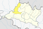
 Thakre Location in Nepal | |
| Coordinates: 27°43′30.81″N 85°5′39.26″E / 27.7252250°N 85.0942389°ECoordinates: 27°43′30.81″N 85°5′39.26″E / 27.7252250°N 85.0942389°E | |
| Country | Nepal |
| District Dhading | Dhading |
| Province3 | Province No. 3 |
| Rural Municipality | Thakre |
| Area | |
| • Total | 96.41 km2 (37.22 sq mi) |
| Population (2017)[1] | |
| • Total | 32,914 |
| • Density | 340/km2 (880/sq mi) |
| Time zone | UTC+5:45 (NST) |
| Area code(s) | 010 |
| Website | thakremun |

Thakre (Nepali: थाक्रे; thakre) is a Gaupalika(Nepali: गाउपालिका ; gaupalika)[2](Formerly: village development committee) in Dhading District. The local body was formed by merging four VDCs namely Bhumesthan, Tasarphu, Thakre, Kebalpur and Goganpani, Bagmati (Ward No. 5,6,7,8). Currently, it has a total of 11 wards. The population of the rural municipality is 32,914 according to the data collected on 2017 Nepalese local elections.
Geography[]
East: Dhunibesi Municipality
West: Galchhi Gaupalika
North: Galchhi Gaupalika and Nuwakot District
South: Makawanpur District
Population[]
As per 2017, Thakre hosts a population of 32,914 across a total area of 96.41 km2.
See also[]
References[]
- ^ "MOFALD List of Gaupalika" (PDF). Retrieved 2017-06-02.
- ^ "यसरी २ नगर र ११ गाउँपालिकामा बाँडिनेभयो धादिङलाई (स्पष्ट नक्सासहित)". Sajhapost. Nov 11, 2016.
Categories:
- Populated places in Dhading District
- Rural municipalities in Dhading District
- Rural municipalities of Nepal established in 2017