Königstein, Bavaria
Königstein | |
|---|---|
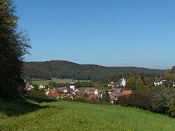 View towards Königstein | |
 Coat of arms | |
show Location of Königstein within Amberg-Sulzbach district | |
 Königstein | |
| Coordinates: 49°36′26″N 11°38′00″E / 49.60722°N 11.63333°ECoordinates: 49°36′26″N 11°38′00″E / 49.60722°N 11.63333°E | |
| Country | Germany |
| State | Bavaria |
| Admin. region | Upper Palatinate |
| District | Amberg-Sulzbach |
| Government | |
| • Mayor (2020–26) | Bernhard Köller[1] |
| Area | |
| • Total | 28.27 km2 (10.92 sq mi) |
| Elevation | 490 m (1,610 ft) |
| Population (2020-12-31)[2] | |
| • Total | 1,758 |
| • Density | 62/km2 (160/sq mi) |
| Time zone | UTC+01:00 (CET) |
| • Summer (DST) | UTC+02:00 (CEST) |
| Postal codes | 92281 |
| Dialling codes | 09665 |
| Vehicle registration | AS |
| Website | www |


Königstein, also referred to as Königstein (Oberpfalz) to distinguish it from other places named Königstein, is a market town in the Amberg-Sulzbach district, Bavaria, Germany. It is located 45 kilometres (28 mi) NE of Nuremberg.
Points of interest[]
The Ossinger hill reaches 653 metres (2,142 ft) and is the second-highest hill in Upper Palatinate. There is a tower at the peak from which there are views of the surrounding Upper Palatinate and Franconian Jura countryside, as well as a hut (in German) that offers light refreshments.
Breitenstein Chapel is a two-story chapel situated on a rock out-cropping that dates from the second half of the 12th century. Common folk worshipped on the lower floor, while the nobility enjoyed the upper floor.
Golf Königstein (in German) is an 18-hole golf course.
Districts[]
- Bischofsreuth
- Breitenstein
- Döttenreuth
- Fichtenhof
- Funkenreuth
- Gaißach
- Hannesreuth
- Kürmreuth
- Loch
- Lunkenreuth
- Mitteldorf
- Mönlas
- Namsreuth
- Pruihausen
- Röslas
- Wildenhof
- Windmühle
- Ziegelhütte
The Königstein golf course is a challenging par 72 that is spread out through the Oberpfalz countryside with scenic views of the Oberpfalz Mountains on the front nine, and forest on the back nine. There is a very good practice area/practice tee for those who want to work on their game. The course is located about 10 kilometers from the Vilseck Army Community.
Königstein is a tourist area frequented by Germans who enjoy "wandering" or long walks through the countryside. Also horseback riding, golfing, rappelling, and mountain biking on the beautiful trails in the scenic countryside. The village of Königstein has several restaurants serving a variety of German cuisine.
Twinnings[]
References[]
- ^ Liste der ersten Bürgermeister/Oberbürgermeister in kreisangehörigen Gemeinden, Bayerisches Landesamt für Statistik, 15 July 2021.
- ^ "Tabellenblatt "Daten 2", Statistischer Bericht A1200C 202041 Einwohnerzahlen der Gemeinden, Kreise und Regierungsbezirke". Bayerisches Landesamt für Statistik (in German). June 2021.
| show Towns and municipalities in Amberg-Sulzbach |
|---|
| show Authority control |
|---|
- Municipalities in Bavaria
- Amberg-Sulzbach