Ursensollen
This article needs additional citations for verification. (March 2007) |
Ursensollen | |
|---|---|
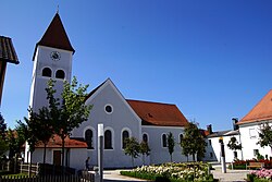 Church of Saint Vitus | |
 Coat of arms | |
show Location of Ursensollen within Amberg-Sulzbach district | |
 Ursensollen | |
| Coordinates: 49°24′4″N 11°45′28″E / 49.40111°N 11.75778°ECoordinates: 49°24′4″N 11°45′28″E / 49.40111°N 11.75778°E | |
| Country | Germany |
| State | Bavaria |
| Admin. region | Oberpfalz |
| District | Amberg-Sulzbach |
| Government | |
| • Mayor (2020–26) | Albert Geitner[1] |
| Area | |
| • Total | 72.91 km2 (28.15 sq mi) |
| Elevation | 537 m (1,762 ft) |
| Population (2020-12-31)[2] | |
| • Total | 3,759 |
| • Density | 52/km2 (130/sq mi) |
| Time zone | UTC+01:00 (CET) |
| • Summer (DST) | UTC+02:00 (CEST) |
| Postal codes | 92289 |
| Dialling codes | 09628 |
| Vehicle registration | AS |
| Website | www |


Ursensollen is a municipality in the district of Amberg-Sulzbach in Bavaria in Germany.
Geography[]
Ursensollen is in the region Upper Palatinate-North about 10 km to the west of Amberg.
The following districts belong to this town: Allmannsfeld, Bittenbrunn, Egelhofen, Eigentshofen, Ehringsfeld, Erlheim, Garsdorf, Götzendorf, Gunzelsdorf, Guttenberg, Haag, Hausen, Häuslöd, Heimhof, Heinzhof, Hohenkemnath, Inselsberg, Kemnatheröd, Kotzheim, Littenschwang, Oberhof, Oberleinsiedl, Ödallerzhof, Reinbrunn, Reusch, Richt, Richtheim, Rückertshof, Salleröd, Sauheim, Stockau, Thonhausen, Ullersberg, Unterleinsiedl, Ursensollen, Wappersdorf, Weiherzant, Winkl, Wollenzhofen, Zant.
Population[]
The districts of the town had a population of 2,678 in 1970, 3,518 in 2000, and 3,745 in 2009.
References[]
- ^ Liste der ersten Bürgermeister/Oberbürgermeister in kreisangehörigen Gemeinden, Bayerisches Landesamt für Statistik, 15 July 2021.
- ^ "Tabellenblatt "Daten 2", Statistischer Bericht A1200C 202041 Einwohnerzahlen der Gemeinden, Kreise und Regierungsbezirke". Bayerisches Landesamt für Statistik (in German). June 2021.
| show Towns and municipalities in Amberg-Sulzbach |
|---|
| Authority control |
|---|
This Amberg-Sulzbach location article is a stub. You can help Wikipedia by . |
- Municipalities in Bavaria
- Amberg-Sulzbach
- Upper Palatinate geography stubs