Kadugli Airport
Kadugli Airport | |||||||||||
|---|---|---|---|---|---|---|---|---|---|---|---|
| Summary | |||||||||||
| Airport type | Public | ||||||||||
| Operator | Government | ||||||||||
| Location | Kadugli, Sudan | ||||||||||
| Elevation AMSL | 1,848 ft / 563 m | ||||||||||
| Coordinates | 11°08′16″N 029°42′04″E / 11.13778°N 29.70111°ECoordinates: 11°08′16″N 029°42′04″E / 11.13778°N 29.70111°E | ||||||||||
| Map | |||||||||||
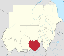 HSLI Location of airport in Sudan (South Kurdufan state highlighted) | |||||||||||
| Runways | |||||||||||
| |||||||||||

Kadugli Airport (IATA: KDX, ICAO: HSLI) is an airport serving Kadugli[1] (also spelled Kaduqli), the capital city of the state of South Kurdufan (or South Kordofan) in Sudan.
Facilities[]
The airport resides at an elevation of 1,848 feet (563 m) above mean sea level. It has one runway designated 06/24 with an asphalt surface measuring 2,553 by 53 metres (8,376 ft × 174 ft).[1]
Airlines and destinations[]
| Airlines | Destinations |
|---|---|
| Tarco Airlines | Khartoum[3] |
Incidents[]
- On 10 November 1979, Douglas C-47B ST-AHH of the crashed at Kadugli Airport and was destroyed by the subsequent fire.[4]
References[]
- ^ a b c Airport information for HSLI from DAFIF (effective October 2006)
- ^ Airport information for HSLI at Great Circle Mapper. Source: DAFIF (effective October 2006).
- ^ "Archived copy". Archived from the original on 2015-07-06. Retrieved 2015-08-14.
{{cite web}}: CS1 maint: archived copy as title (link) - ^ "ST-AHH Accident description". Aviation Safety Network. Retrieved 29 July 2010.
External links[]
Categories:
- Airports in Sudan
- South Kordofan