Kames Bay, Loch Melfort
| Kames Bay | |
|---|---|
 Kames Bay, Loch Melfort. The north east view of Kames Bay and Loch Melfort beyond. | |
 Kames Bay | |
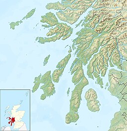
| Location | Argyll and Bute, Scotland |
| Coordinates | 56°14′55.345″N 5°30′57.701″W / 56.24870694°N 5.51602806°WCoordinates: 56°14′55.345″N 5°30′57.701″W / 56.24870694°N 5.51602806°W |
| Ocean/sea sources | |
| Basin countries | Scotland |
| Max. length | 0.658 km (0.409 mi) |
| Max. width | 0.346 km (0.215 mi) |
Kames Bay is small remote tidal north by northwest facing coastal embayment forming part of the southern coast of within Argyll and Bute, Scotland.[1][2]
Settlements[]
The main A816 road from Oban to Lochgilphead passes the bay. To the south west is the small village of Arduaine situated close to the and Asknish Bay. To the north east is the small settlement of Kilmelford.
Kames Bay hosts a fish farm.

Geography[]
To the east, the bay is bounded by Rubh án Àird Fhada point. To the west is the small tidal sea loch , which provide a sheltered haven for yachts.[3] On the other side of Loch Melfort from the bay, is the small rocky island of Eilean Coltair to the north west. Further to the west is the larger which contains the island. Directly opposite is the Bàgh na Dalach Dubh-Chlachaich point and east at the head of Loch Melfort is the
References[]
- ^ Microsoft; Nokia (28 March 2017). "Editing Kames Bay, Loch Melfort" (Map). Bing Maps. Microsoft. Retrieved 28 March 2017.
- ^ "Kames Bay". Scotlands Gardens. Scotlands Gardens, Edinburgh. 2012. Retrieved 31 March 2017.
- ^ Perrin Towler; Mark Fishwick (6 October 2016). Reeds Western Almanac 2017. Bloomsbury Academic. pp. 64–. ISBN 978-1-4729-3053-8.
- Bays of Highland (council area)
- Bays of Scotland
- Bays of Argyll and Bute